Geoscience Reference
In-Depth Information
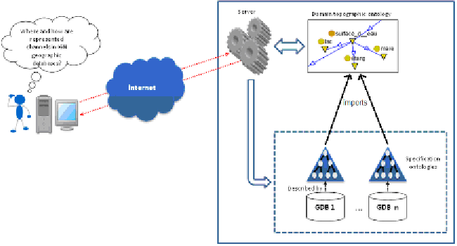
Our system runs on a client-server architecture, including a web mapping
solution for data visualization in the client's side. It is composed of three
important modules.
1.
The search module: this module guides the user, through an auto-
completion solution, to express his/her query, i.e. to specify which
data s/he is looking for using terms designating concepts in the
topographic domain ontology. Indeed, the interest of the
topographic domain ontology is two-fold: it is supposed to contain
a shared vocabulary rather than a technical one, and all formalized
specifications of databases rely on it. The topographic domain
ontology is thus used to express user's needs and is a pivot in our
system.
Figure 3:
System architecture
2.
The information extraction module: once the user selects the label
of a given geographic concept of interest, the system extracts,
from the local specification ontologies, information about the data
referred to by this term. This piece of information, including
definitions, geometries of represented objects etc., is sent to the
user.
3.
The cartographic module: the system uses information obtained
from the specification ontologies to retrieve data corresponding to
the user's need in the different geographic databases. Data are sent
to the user for visualization through a web mapping solution.