Environmental Engineering Reference
In-Depth Information
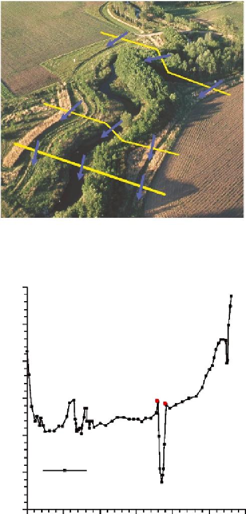
A river cross section is typically measured perpendicular to the low direction, as illustrated in
Figure 4.6. The cross-sectional geometry of a river is represented by a series of points, each point
speciied by a pair of
X
and
Z
values. The value
X
denotes the distance of the point along the cross
section from some starting point, by convention on the left bank facing downstream. The ground
elevation, with respect to a datum, is denoted by
Z
. A cross-section proile is typically identiied by
the name of the river, the station, and sometimes by geographic coordinates (Figure 4.7).
⊥
To flow
FIGURE 4.6
River cross sections. (From NRCS. Introduction to HecRAS. Available from http://www.nrcs.
usda.gov/wps/portal/nrcs/detailfull/national/water/?cid=stelprdb1042484, 2004.)
1830
1825
1820
1815
1810
Ground
1805
Bank station
1800
0
200
400
600
800
1000
1200
FIGURE 4.7
An example of a river cross section.

Search WWH ::

Custom Search