Environmental Engineering Reference
In-Depth Information
South
North
Line direction
156
158
152
150
154
Side reflections
from bridge piers
50
Pier 14
Pier 12
Pier 13
Former Missouri
river channel
Recent river deposits
100
150
Possible fault /glide plane
Horizon A
200
Horizon B
Multiples
250
200 ft
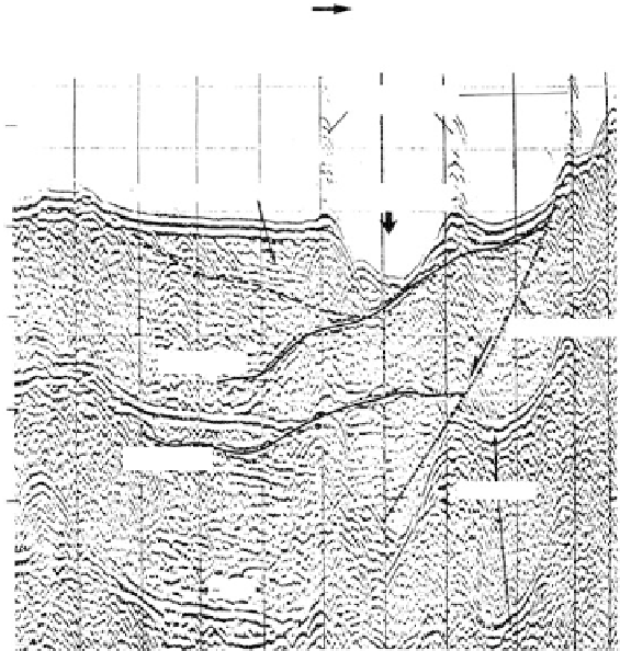
FIGURE 2.29
Subbottom profiling with bubble pulser to locate possible failure surface at toe of landslide. Section is in area
of side-scan sonar image (see
Figure 2.9)
.
(Courtesy of Woodward-Clyde Consultants.)
Campeche
escarpment
DSDP
3,87
Seismic units
Sigsbee
Cinco de Mayo
Mexican ridges
SE
Seafloor
NW
5.0
6.0
??? ?
7.0
Campeche
8.0
Challenger
Depth 10 km*
9.0
?
10 km
Challenger Knoli
salt dome
DSDP-2
*Approximate depth computed from refraction profile data
Seafloor
SE
NW
5.0
Sigsbee
Cinco de Mayo
Mexican ridges
6.0
7.0
8.0
Campeche
Salt
9.0
Challenger
Viejo
10 km
Fault?
"Acoustic basement"
FIGURE 2.30
Part of multichannel seismic reflection section, abyssal western Gulf of Mexico. (From Ladd, J. W. et al.,
Geology, GSA, 1976. With permission.)