Environmental Engineering Reference
In-Depth Information
fans along a great number of closely spaced channels (see
Figure 2.7
and
Figure 7.30).
The
flow, termed “sheet wash,” enters larger channels or washes, connecting with the river
channels in the valley, where it fills the floodplains and causes severe bank erosion. A shal-
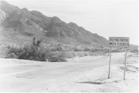
low swale, representing a dry wash, is shown in
Figure 8.16.
Note the sign “Do not enter
when flooded.”
Stereoscopic interpretation of aerial photographs permits delineation of floodplain lim-
its because of the distinctive boundaries evidenced by low escarpments, in reality inter-
mittent river banks. On the aerial photo presented in
Figure 8.17,
taken about 30 years ago,
three flood zones are shown:
1.
The channel of the Pantano Wash carries water intermittently, but usually several
times a year.
2.
The area referred to as the “recent floodplain area” floods only occasionally, usu-
ally on at least a yearly basis.
3.
The “geologic floodplain” delineates the boundary in which flooding has
occurred during recent past geologic history. The mobile home park was placed
there because of the flat terrain of the terrace. Its position must be considered as
precarious.
Flood Protection
Floodplain
zoning affords the best protection against flooding from the viewpoint of com-
munity development, since construction can be prohibited. Floodplains are useful as a nat-
ural storage area for floods, and can provide inner-city open space and parkland. They
usually also represent the best farmland.
Construction at adequately high elevations
can be accomplished either by selecting a site on
high natural ground, or by raising the grade by filling. In either case, consideration should
be given to the effect of possible future development on flood levels. Extensive filling will
increase upstream flooding.
Diking
to contain water is a necessary solution for many rapidly growing cities, but it is
expensive and not necessarily risk-free because flood levels are not only difficult to pre-
dict with certainty, but are affected by natural and development changes.
Channel straightening and lining
is a solution often applied to small rivers and streams to
increase flow velocity and reduce the flood hazard and bank erosion. In addition to aes-
thetic objections, it has the disadvantage of increasing downstream flows and therefore the
flood hazard at some other locations.
FIGURE 8.16
Roadway crossing a wash, or arroyo
(Canada del Oro area, Tucson, Arizona).
Such locations present a severe danger to
motorists during high runoff.