Environmental Engineering Reference
In-Depth Information
After development
During development
Storm-water
management
Predevelopment
FIGURE 8.14
Unit hydrographs for various conditions
at a given site.
Time from start of storm
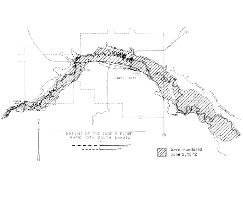
FIGURE 8.15
Map of Rapid City showing the area inundated by the June 9, 1972, flood, and the area mapped as Quarternary
alluvium on the U.S. Geological Survey 7
1
2
min quadrangle maps. Black dots show locations of bodies
recovered after the flood. (From Rahn, P.H.,
Bull. Assoc. Eng. Geol.,
XII, 2, 1975.)
city as nonresidential. Most of the area has been converted into parkland but some com-
mercial establishments have been permitted to remain.
Example: Flash Floods in an Arid Climate In the near-desert environment, stream flow
is intermittent and channels are normally dry but easily recognized. Storm runoff from
mountain areas flows across the lower “bajadas,” forming multiple coalescing alluvial