Environmental Engineering Reference
In-Depth Information
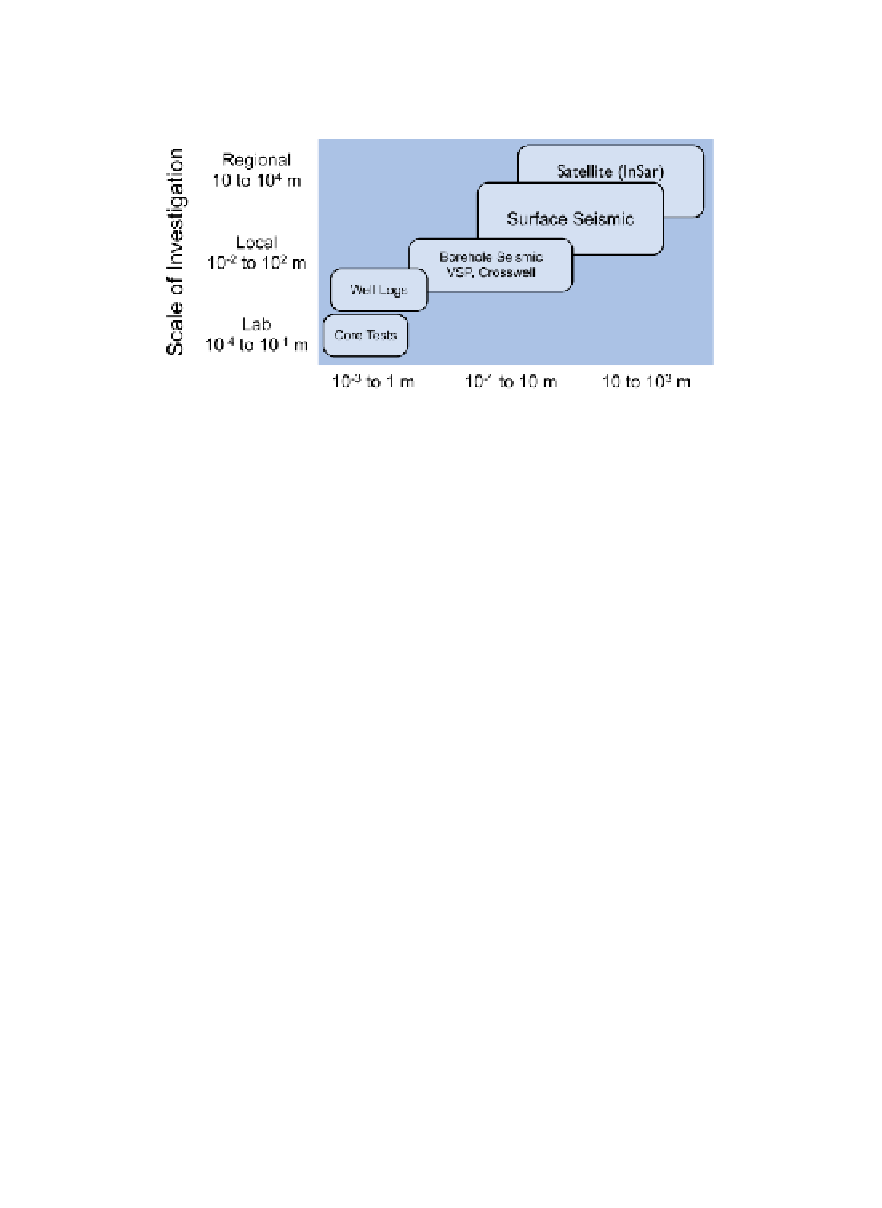
Figure 10.5.1
Scale of subsurface monitoring
Scale of investigation (or spatial coverage) vs. spatial resolution for monitoring of sub-
surface systems.
Figure adapted from Tom Daley (LBNL).
Nevertheless, active research is being carried out by industry and aca-
demia to continue to improve deep subsurface monitoring. The needs of
sequestration monitoring in particular are driving development of
improved resolution to verify CO
2
storage. In this section, we focus on
two of the more important methods (seismic monitoring and InSAR) and
present examples of their use in geological carbon sequestration.
Seismic monitoring
Seismic monitoring is typically carried out by applying vibrational energy to
the ground surface and recording and interpreting the refl ections from deep
structures at nearby instruments.
Figure 10.5.2
shows two different kinds
of seismic sources, surface seismic sources, e.g., provided by a vibroseis
truck, and well-based seismic sources, e.g., provided by a spinning eccen-
tric mass. The resulting seismic signals can be recorded by seismometers
either at the surface or in the well. The fi gure shows various acoustic signals
propagating through the rock-fl uid system and related refl ections and
refractions arising from contrasting seismic wave propagation properties of
the rock-fl uid system. The fi gure also illustrates the complexities involved
in the collection and interpretation of data using this method.


Search WWH ::

Custom Search