Geoscience Reference
In-Depth Information
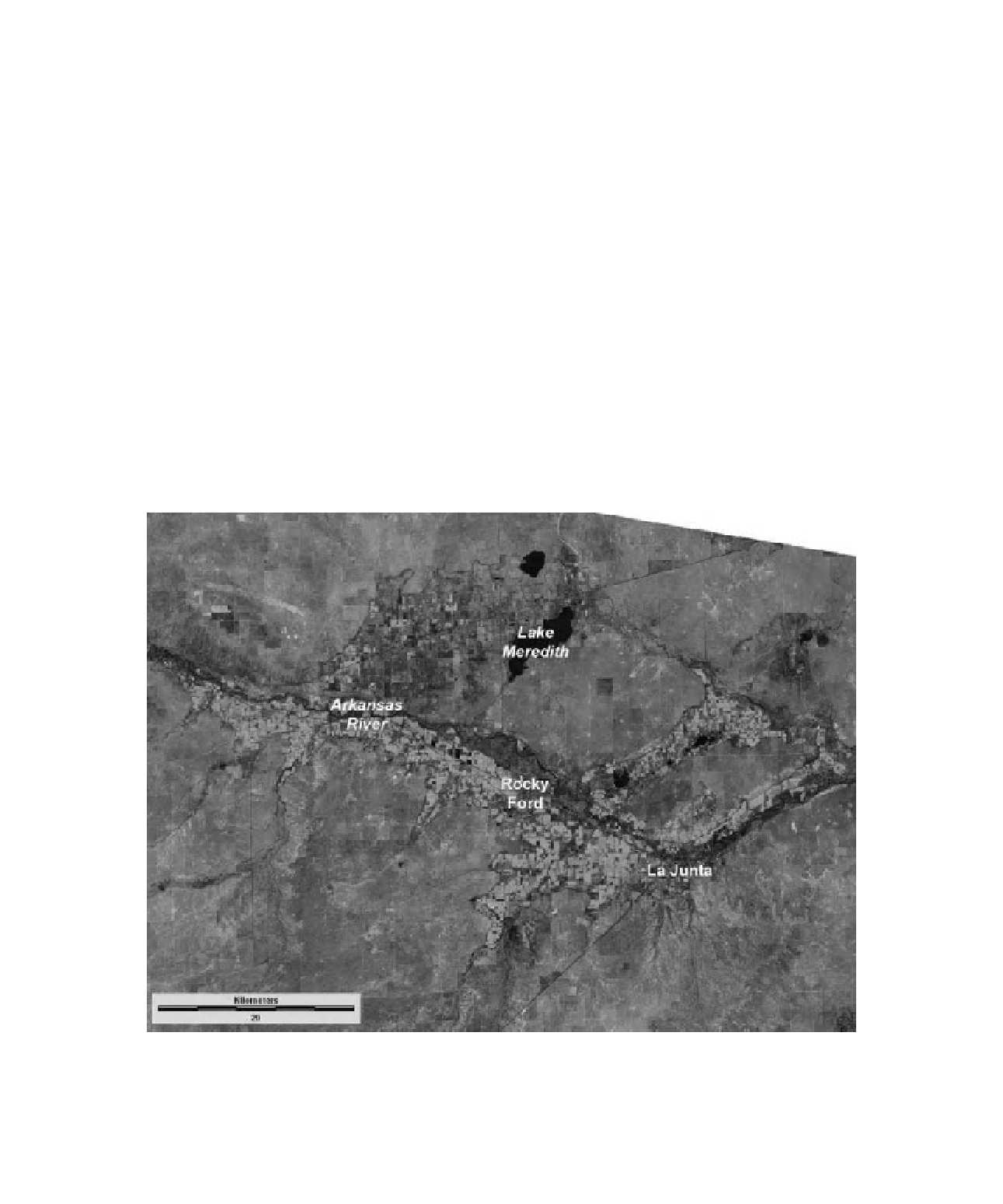
Figure 16-3.
Overview of Lake Pueblo and Pueblo Dam on the Arkansas River, just west of Pueblo, Colorado. Part
of a i sh hatchery is visible to right. Canal across the bottom of scene is supplied by Lake Pueblo and is operated
by the Bessemer Irrigating Ditch Co. Kite aerial photograph by S.W. Aber, J.S. Aber and D. Eberts.
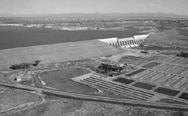
Figure 16-4.
Satellite image of the Arkansas River valley in the Rocky Ford-La Junta vicinity, southeastern
Colorado, United States (see Color Plate 16-4). Bright green indicates irrigated crops; maroon-pink shows dry
upland areas. Lake Meredith is a major storage point for water diverted from the Arkansas River. Landsat TM bands
2, 4 and 5 color coded as blue, green and red; 7 August 2009. Image from NASA; processing by J.S. Aber.