Geoscience Reference
In-Depth Information
Figure 16-5.
View over the eastern portion of Lake Meredith with Sugar City in the left background. Note the
well-developed wetland vegetation in the foreground; the bushy trees are saltcedar. Colorado, United States; helium
blimp airphoto by S.W. Aber and J.S. Aber.
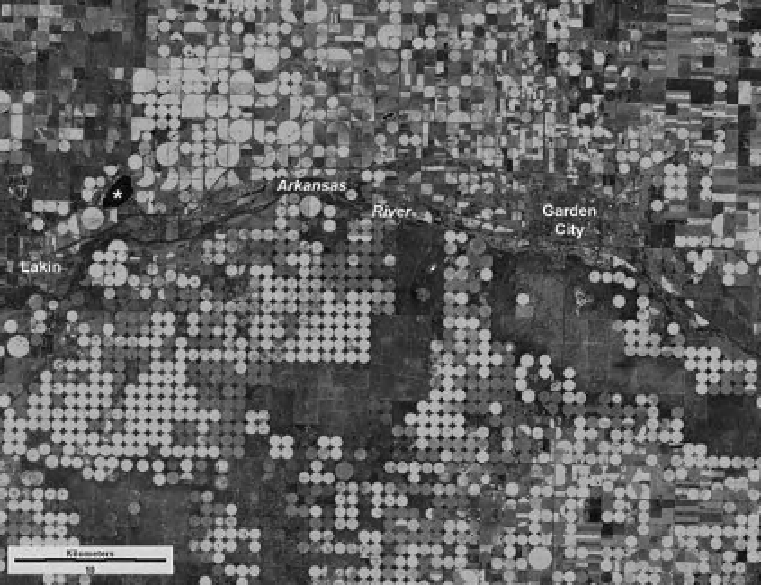
Figure 16-6.
Satellite image of the Arkansas River valley in the Lakin-Garden City vicinity, southwestern Kansas,
United States (see Color Plate 16-6). Bright green indicates irrigated crops; maroon-pink shows dry-fallow areas.
Small irrigation circles are one-half mile (0.8 km) in diameter; large circles are one mile (1.6 km) in diameter.
Asterisk (*) indicates Lake McKinney, a holding point for water diverted from the Arkansas River via the Amazon
Ditch (next i gure). Landsat TM bands 2, 4 and 5 color coded as blue, green and red; 4 August 2007. Image from
NASA; processing by J.S. Aber.