Geography Reference
In-Depth Information
40
In % (relative to 200 observed MS with abstract)
30
20
10
0
(a)
25
20
15
10
5
0
(b)
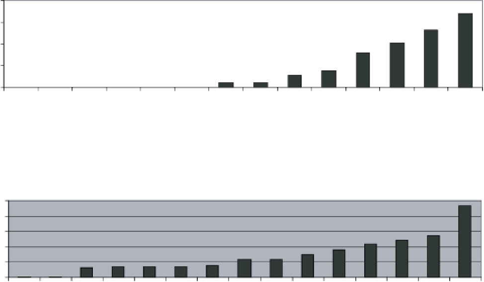
Figure 1.4
Frequency of terms within the abstracts of the 200 manuscripts (in % of the studied manuscripts): a) platforms,
b) sensors.
100
Radar/Sar
InfraRed
Thermal Infra-Red imagery
Lidar
DEM
Photograph
Video
Photogrammetry
Landsat imagery
Aerial/airborne imagery
"Remote Sensing"
"River management"
90
80
70
60
50
40
30
20
10
0
1990
1992
1994
1996
1998
2000
2002
2004
2006
2008
2010
2012
Figure 1.5
Cumulative frequency curve (in % of papers) of each of platforms/sensors cited in the 200 papers of the Web of Science
dealing with rivers and remote sensing. We compared the temporal evolution of frequency for the terms ''Remote sensing'' and
''River management'' in the 200 studied manuscript within the whole Web of Science dataset.


Search WWH ::

Custom Search