Geography Reference
In-Depth Information
Ecological
and habitat
studies
Water
Sciences
Geomorphology
0
5
10
15
20
25
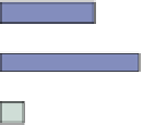
Figure 1.6
Review of abstracts of 203
manuscripts to identify the main topics (in
% of the studied manuscripts).
chemistry, hydraulics and hydrology and which study
specific topics such as plumes, pollution, suspended
sediment concentrations, stream temperature, flooding,
discharge and velocity are seeing an increasing depen-
dence on FRS (33.5% of papers). Third, with the aim of
improving and often of up-scaling the data acquisition
process in traditional fluvial geomorphology, inquiries
relating to regional and tectonic settings, bank erosion
monitoring and decadal channel shifting, geomorphic
changes, channel geometry, bathymetry, grain size, have
all seen an increasing use of remote sensing data (27%
of papers).
Figure 1.7 presents box and whisker plots showing
the publication periods for the five most frequent topics
shown on the vertical axis of Figure 1.6. This shows
that some of the topics have emerged fairly recently
such as SSC & Water Chemistry for which most of the
papers were published between 2008 and 2009 on habitat
mapping and riparian features, whereas others are more
popular all along the studied period such as flooding and
geomorphic changes.
In addition to the timing of publications, we briefly
examined the abstract content for these five topics in
order to identify the main research thrusts within each
area. In the case of habitat mapping, vegetation map-
ping is by far the most dominant application of remote
sensing. Studies range from native vegetation assessment
to the identification of invasive species. Satellite plat-
forms are the major source of data but airborne platforms
seem increasingly utilised. We also find a few published
works using underwater video in order to characterise
fish and animal behaviour. However, these studies of fish
behaviour and/or habitat are actually rare which indicates


Search WWH ::

Custom Search