Geology Reference
In-Depth Information
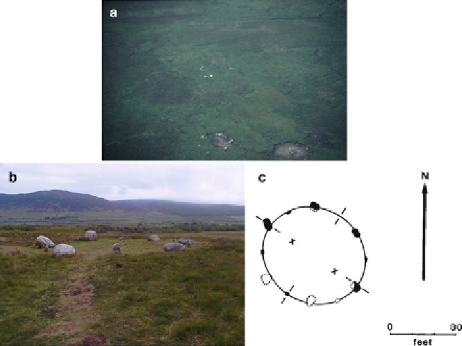
F
IG
. 9.23
(
a
)
Elliptical Circle
1 (
left
), Circle 1A (
right
), Circle 2 remains
above (Photo by Chris Stanley, 1982). (
b
)
Elliptical ring
at ground level
(Photo by Chris O'Kane). (
c
) Tormore ellipse plan (Griffith Observatory
drawing for 'Archaeoastronomy from the Air' [
5
])
up. Ron had also asked for coverage of a medieval village on the
grounds of Hunterston House, adjacent to Hunterston nuclear
power station. We thought we would be forbidden to overfly it,
but did so unchallenged.
A last cautionary tale now emerges. I had passed Ron's maps
to Leslie but somehow they had become separated from the flight
package - and I did not have a copy. Duplicate everything! Although
Chris was well pleased with the chance to photograph the reactor
buildings and the nearby Hunterston Ore Terminal, once again we
couldn't find the archaeological targets because we didn't know
precisely where to look. We gained a good shot of the Three Sisters
(Fig.
9.24
), but I hadn't been to the observatory at the time, and
since I knew it was overgrown but didn't know where it was there
seemed little point in searching.
When I did visit the site, I pointed out to John Bonsor that the
Search WWH ::

Custom Search