Geoscience Reference
In-Depth Information
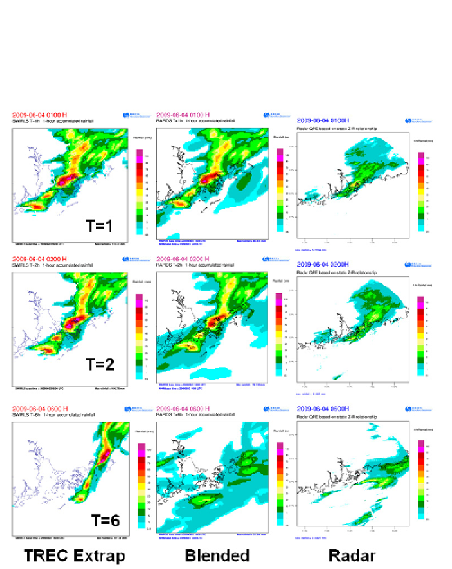
to the nowcasts in the early stages and towards the model at the longer lead times. Figure
13 shows the comparison between the effects of ATNS using SWIRLS simple extrapolation
(1-6 hours forecasts) and ATNS using SWIRLS-NHM blended forecasts for the case of 4 Jun
2009 (1-6 hour forecasts). The simple TREC extrapolation (left column) overpredicts the
rainfall intensities in this case at long lead times (6 hours).
Fig. 13. An example showing the comparison between the effects of SWIRLS simple
extrapolation and blending of SWIRLS and NHM rainfall. Figures from top to bottom are 1-
hr, 2-hr and 6hr simple extrapolation (left column), AANS blended precipitation (middle
column) forecasts and the radar-based QPE (different scale).