Geoscience Reference
In-Depth Information
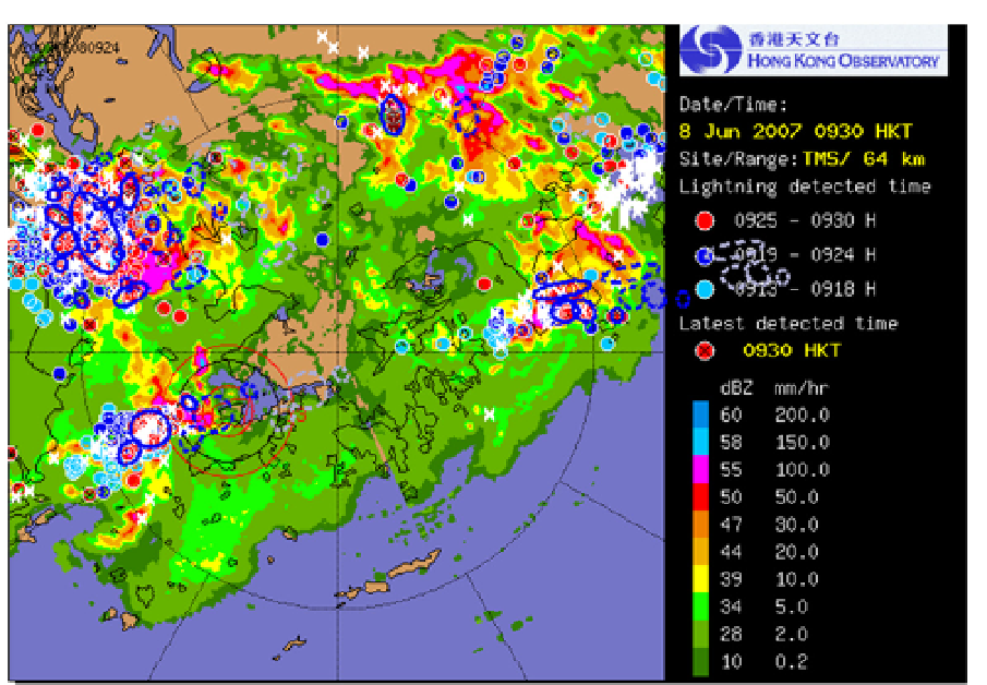
Fig. 12. A snapshot of ATLAS webpage. The image shows the actual position of the CGs
(ellipses with solid line), the predicted CGs (ellipses with dashed line), the 12-minute
forecast in blue and the 30-minute forecast in grey.
The Aviation Thunderstorm Nowcasting System (ATNS) has been developed to predict the
movement of thunderstorms to help local Air Traffic Management to better manage the
flight traffic over the Hong Kong Flight Information Region for the next few hours (Li and
Wong, 2010). A blending approach is adopted to extend the forecast range and to capture
the development and dissipation of thunderstorms. The NWP model used is a high
resolution non-hydrostatic model with horizontal resolution of 5 km (Li et al. 2005; Wong et
al. 2009). Volume radar reflectivity data are ingested into the model via the LAPS data
assimilation system (Albers et al. 1996) and radar Doppler radial wind and 3D radar winds
are assimilated via the JNoVA-3DVAR data assimilation system (Honda et al. 2005) to
improve the initial moisture field and wind fields, respectively.
The blending algorithm is as follows: (i) SWIRLS radar forecast reflectivity is converted into
surface precipitation using a dynamic reflectivity-rainfall (Z-R) relation; (ii) precipitation
forecasts are extracted from the NHM; and (iii) then they are blended. The latter blending
process involves: (i) Phase correction where a variational technique minimizes the root
mean square error of the forecast rainfall field from a previous model run (usually
initialized at 1-2 hours before) and the actual radar-raingauge derived precipitation
distribution (Wong et al. 2009). (ii) Calibration of the QPF rainfall intensities is based on the
observed radar-based quantitative precipitation estimate (QPE), and (iii) blending of
calibrated model QPF with the radar nowcast out to 6 hours where the weighting is biased