Environmental Engineering Reference
In-Depth Information
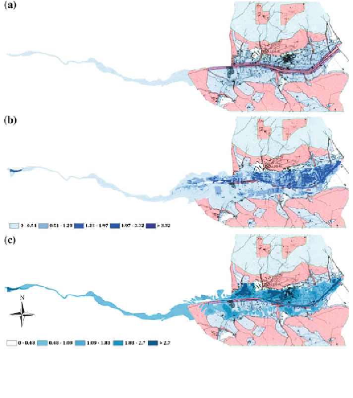
Fig. 6.69 a Multi hazard zones provided by PPR since 1995 onwards (the red and blue colors
correspond to channel and inundation zones); b flood hazard map (velocity) for 100 years return
period with the assumption of dyke break; c flood hazard map (depth of water) for 100 years
return period with the assumption of dyke break


Search WWH ::

Custom Search