Environmental Engineering Reference
In-Depth Information
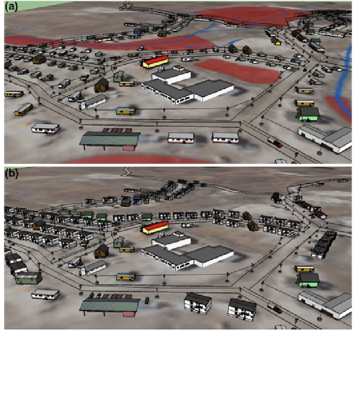
7.3.3.2 A Case Study at Community Scale
The Clyde River project in Nunavut used spatial planning, scenarios, mapping and
SketchUp 3D visualizations in a participatory process with translators to bring
together local and scientific knowledge, build social learning around planning
issues, and visualize potential future resilient pathways for the community. Sce-
nario development was based on four dominant concerns: landscape hazards;
housing shortages (as well as how to plan for future population growth); walk-
ability within the community and quality of life issues; and energy resilience
(Fig.
7.6
). Following review by Hamlet staff and members of the community, two
spatially divergent scenarios were developed to explore spatially distinct devel-
opment alternatives while incorporating more resilient energy production and
Fig. 7.6 Alternative scenarios and supporting analysis for development of the Arctic community
of Clyde River, Nunavut, showing: a official plan overlaid with hazard areas in red, b potentially
resilient redevelopment to increase housing, avoid hazard areas, improve walkability, and reduce
dependence on imported diesel through renewable energy. Credit N. Sinkewicz, D. Flanders,
K. Tatebe, and E. Pond, CALP, UBC. Reproduced from Sheppard (
2012
) ''Visualizing Climate
Change'', Earthscan/Routledge
Search WWH ::

Custom Search