Travel Reference
In-Depth Information
a
Lake Merritt
12th or 19th Street, then AC
Transit 11, 12, 57, 58, 805 bus.
Formed when a saltwater
tidal estuary was dredged,
embanked, and partly dammed,
Lake Merritt and its surrounding
park form an oasis of rich blue
and green in the urban heart of
Oakland. Designated in 1870 as
the first state game refuge in
the United States, Lake Merritt
still attracts migrating flocks of
birds. Rowers can rent boats
from two boathouses on the
west and north shores, and
joggers and bicyclists can circle
the lake on a 3-mile (5-km)
path. The north shore at
Lakeside Park has flower
gardens, an aviary, and a
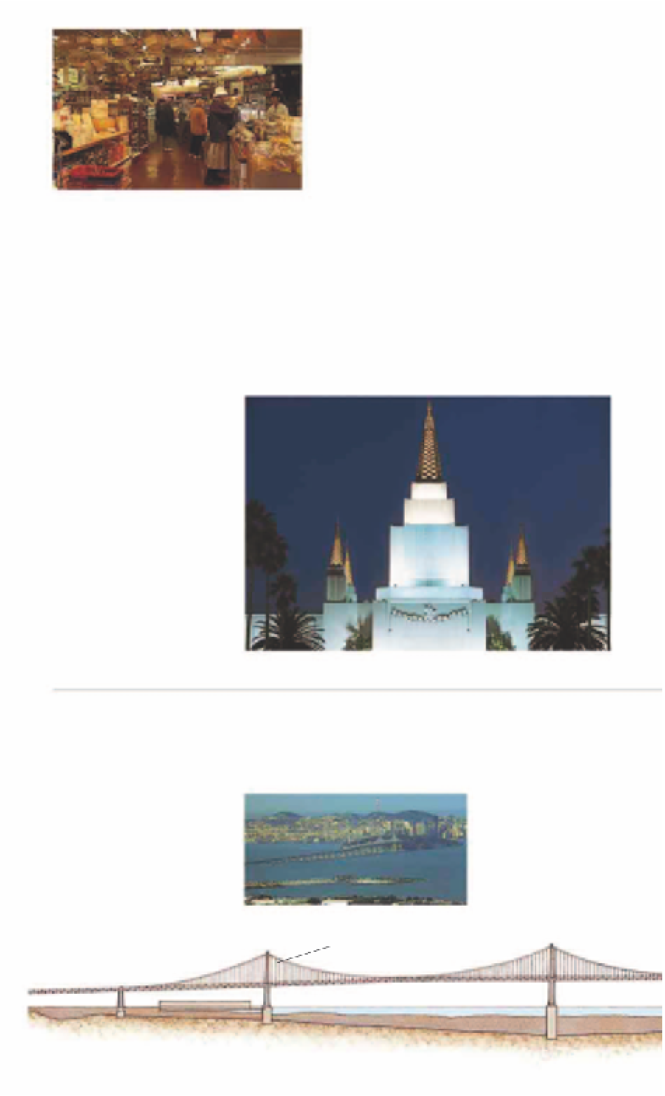
Oakland Temple of
the Church of Jesus
Christ of the Latter
Day Saints. At night
the temple is
floodlit and can be
seen from Oakland
and San Francisco.
The central
ziggurat is
surrounded by four
shorter towers, all
terraced and clad with white
granite and capped by
glistening golden pyramids.
From the temple there are
magnificent views over the entire
Bay Area. The Visitors' Center
offers guided tours by
missionaries, who explain the
tenets of the faith with a series
of multimedia presentations.
Gourmet shops at Rockridge Market Hall
Oakland
i
Rockridge
Rockridge.
A leafy residential area with
large houses and flower
gardens, Rockridge also attracts
shoppers to College Avenue.
There are a variety of shops
and restaurants as well as many
cafés with outdoor tables.
o
Mormon Temple
4770 Lincoln Ave, Oakland.
Tel
(510) 531-1475 (Visitors' Center).
Fruitvale, then AC Transit 46 bus.
Open
9am-9pm daily. Temple: call
the Visitors' Center for times.
^
(except Visitors' Center.)
7
8
of Visitors' Center.
Designed in 1963 and built on
a hilltop, this is one of only two
Mormon temples in Northern
California. Its full name is the
Central ziggurat of the Mormon Temple
p
Bay Bridge
Map
6 E4.
to the Oakland “mainland” with
road and rail. The tracks were
removed in the 1950s, leaving
the bridge for use by more than
250,000 vehicles a day. Five
traffic lanes wide, it has two
levels: westbound traffic
into San Francisco uses the
top deck, eastbound to
Oakland the lower.
The eastern cantilever
section is raised on more
than 20 piers. It climbs
up from the toll plaza
causeway in Oakland
to 191 ft (58 m) above
the bay at Yerba Buena
Island. In 1989 a 50-ft
(15-m) segment of the
The compound, high-level San
Francisco-Oakland Bay Bridge
was designed by Charles H.
Purcell. It has two distinct
structures, joining at Yerba
Buena Island in the middle of
the Bay, and reaches 4.5 miles
(7.2 km) from shore to shore.
Its completion in 1936 heralded
the end of the age of ferryboats
on San Francisco Bay by linking
the peninsular city at Rincon Hill
The East Bay Crossing
10 miles (16 km) of cable holding
up the bridge
2,310 ft (704 m)
The West Bay Crossing section of Bay Bridge