Geography Reference
In-Depth Information
In UAV photogrammetry, determining the exterior orientation of objects is
further complicated because the photographs are usually taken with
non-surveying cameras, where the radial distortion can reach up to 200 m. If the
values of radial distortion cannot be incorporated in the calculation, only 60 % of
the image around its imaginary center should be used. Modern applications can
usually calculate the radial distortion in a single step with the AAT calculation.
Software for the third sides can potentially be used. However, even if the pattern of
the radial distortion is known, using the entire photograph is not recommended,
which reduces the potential distribution of the control points.
Based on our experiments, the effect of the correct distribution of control points
over the terrain on the correct calculation of the external orientation objects is not
negligible. A distribution of points along a straight river or other object is not
recommended. It is always best to use an even distribution of points over the surface
so that none of the points lies on a line between other points. This corresponds to a
random distribution of points.
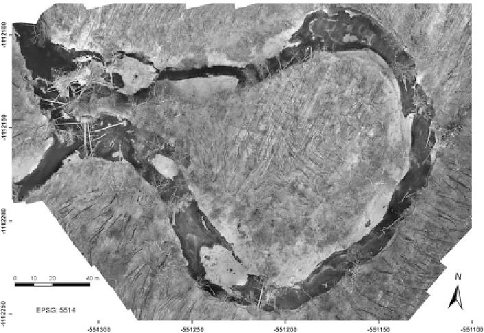
Two sets of images of the Kenick´ meander were collected. The images were
photogrammetrically processed, and a morphometric analysis of the development
of the meander and the woody debris was performed using the processed images
(Fig.
2
). The parameters of the imaging flight and the image processing are shown
in Table
2
.
Fig. 2 Orthophoto of the Kenick´ meander