Database Reference
In-Depth Information
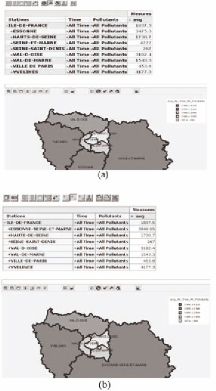
Figure 7. Dissolve operator, a) Input: Ile de France's departments, b) Output: Departments of Ile de
France and the new spatial member Essone-Seine-et-Marne
FUTURE RESEARCH DIRECTIONS
tools functionalities supporting measures defined
as geographic objects (geographic measures) and
implementing three new spatio-multidimensional
operators which change the structure of the spatial
hypercube thanks to spatial analysis operators.
However, some limits remain to overcome: the
integration of ad-hoc indexing techniques (Papa-
dias, et al., 2002) to improve the performance of
our system, and the implementation of mechanisms
for automatically detecting and computing spatial
materialized views (Colonese et al., 2005).
Spatial OLAP technologies have reached matu-
rity. They allow an effective multidimensional
analysis of spatial data warehouses. However,
the introduction of complex spatial data raises
several problems.
Map generalization is mandatory for SOLAP
systems (Bimonte, 2008). On the other hand,
map generalization implies the reformulation of
classical spatial hierarchies by introducing multi-
Search WWH ::

Custom Search