Environmental Engineering Reference
In-Depth Information
Qowd
Qmdi
Qmb
Qlalm
Qow
Qowd
Qmf
Qmdo
Kettles
Qmt
Kettles
Qmt
Milford
Kames
Qmk
Qmbw
Birmingham
Qlc
Qow
Qlsha
Qmf
Novi
Qmdi
Qlsha
Livonia
Qlahm
Qlsg
Qll
Qmd
265
Qlsg
Qlswa
Qlc
Qlsg
200
Varves (Qv)
Mbd
Qmg
Qll
Qllu
Ms
Da
Detroit
Da
Dt
Dd
140
Qfa
Dt
Qlc
Qmo
190
Dd
Ddr
140
Approximate horizontal scale: 1˝ = 6.4 km
scale in kilometers
Rouge River
present day
0
5
10
20
Stratigraphic column
Ms
Qlahm
Qow
Qowd
Qlsw
Qmd
Qmbw
Qmdi
Qmdo
Qmf
Mbd
Qll
Qlalm
Qlsha
Da
Qlc
Qmg
Dt
Qlsla
Qma
Qlsg
unconformity
Dd
Qfa
Qmk
Qmt
Qllu
unconformity
Ddr
Qmo
Qmb
Qaa
unconformity
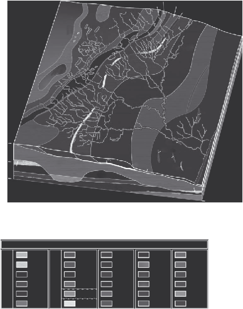
FIGURE 5.16
(See color insert.)
Enlarged and annotated current geologic map of the Rouge River watershed in southeast-
ern Michigan. (From Rogers, D.T. et al.,
Quaternary Geology of the Rouge River Watershed in Southeastern Michigan
,
USA
, 33rd International Geological Congress, Abstracts with Programs, Oslo, Norway, 2008.)


Search WWH ::

Custom Search