Environmental Engineering Reference
In-Depth Information
no true recovery zone exists for this river. The fi ve
sampling stations and their location obtained with
the help of a Geographical Positioning System
(
Garmin, GPS 12XL
) are as follows:
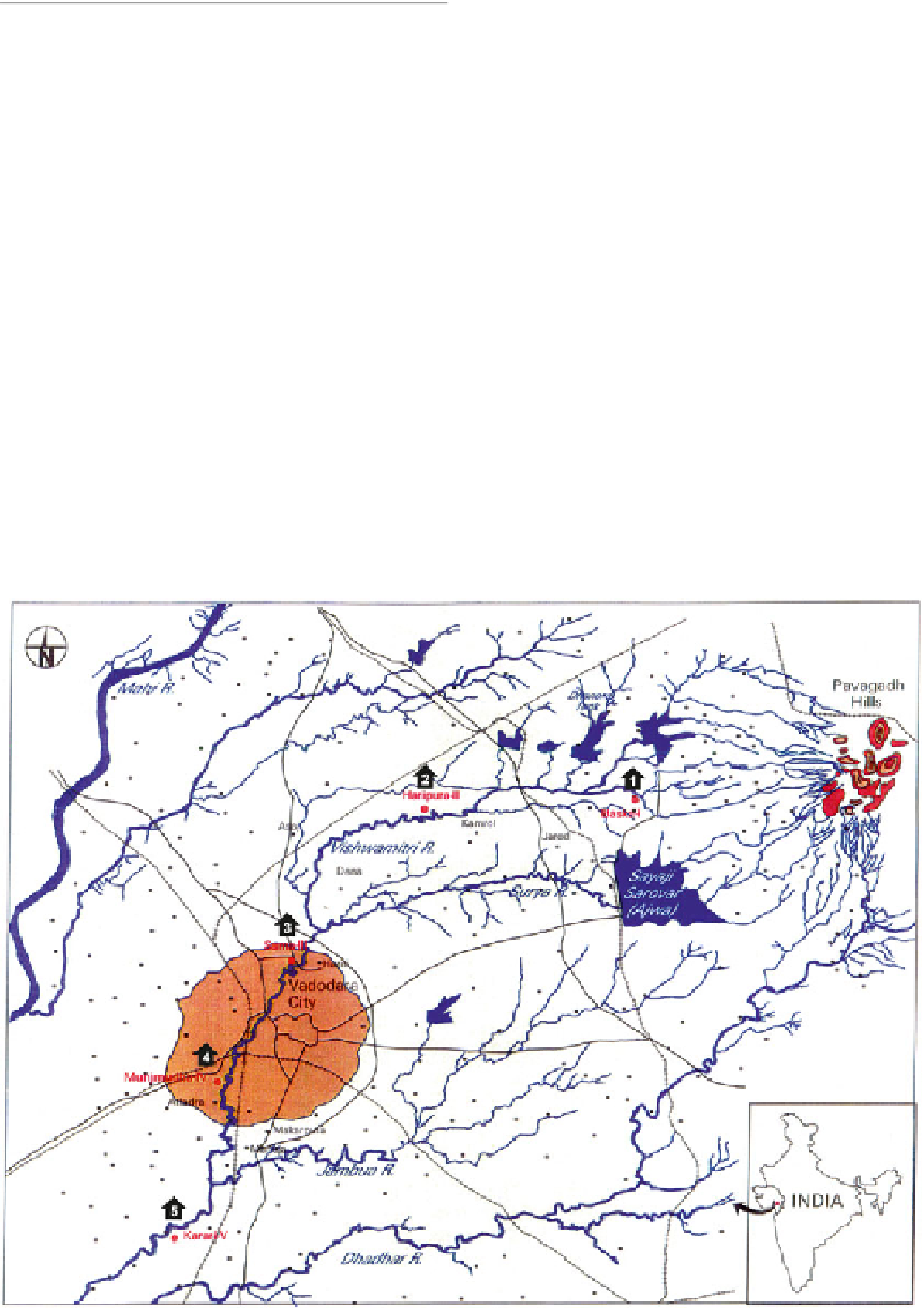
Study Area
Location and Topography (Fig.
6.1
)
Desai and Clarke (
1923
) in “The Gazette of
Baroda” state that the River Vishwamitri takes its
origin from the hills of Pavagadh, which is about
43 km away from the Northeast of Vadodara City.
Of its total length of about 90 km, it fl ows for
58 km through Vadodara district. The entire
stretch of the river was traced through a recon-
naissance survey to select the suitable sampling
stations. Considering the short length of the river,
fi ve sampling stations were selected in a manner
such that two stations were in the clean zone of
the river, two in the septic zone, and one in the
recovery zone. Later, however, it was realized that
Station I: Baska
Position: N - 22° 22.088
′
; E - 73°
27.079
; Altitude - 104 m.
This is the fi rst upstream station near the foot-
hills of Pavagadh. Here the water exists for most
part of the year except in the month of May when
the river dries up completely. By the end of June,
the monsoon water begins to fl ow through the
riverbed again. The river remains in the fl owing
condition for about 4 months. By the end of
November, the water stops fl owing, and slowly
and steadily stagnation sets in and the water level
begins to reduce till only small pools exist in the
river bed till the end of April.
′
Fig. 6.1
Location map of the study area and the sampling stations (1-5)
Search WWH ::

Custom Search