1983 State Plane Coordinate System Constants (The 3-D Global Spatial Data Model)

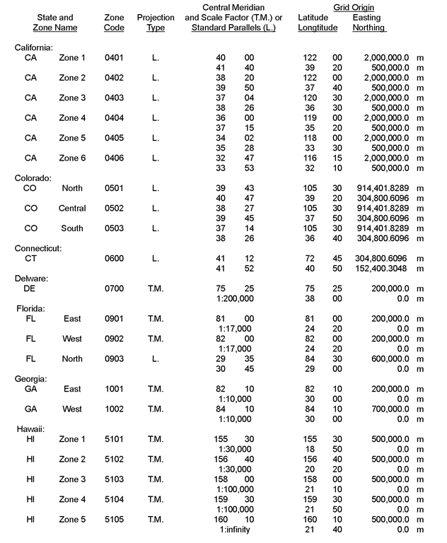
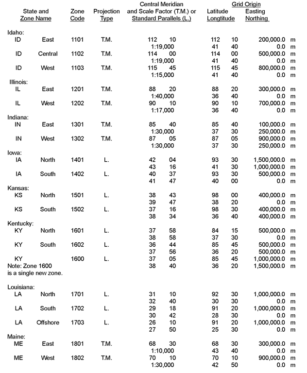
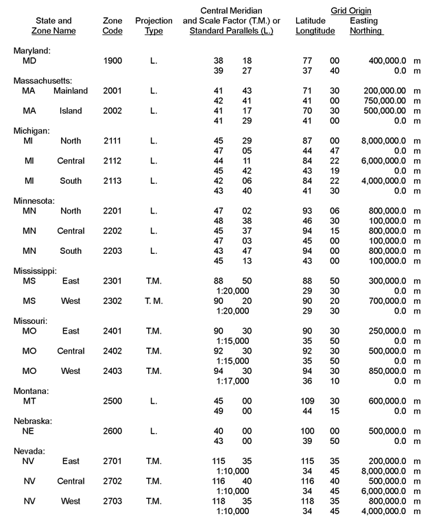
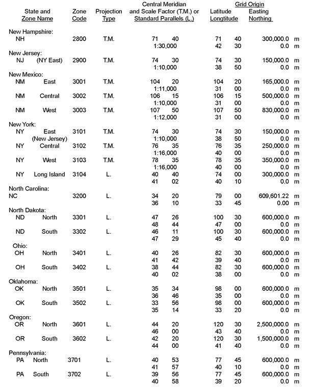
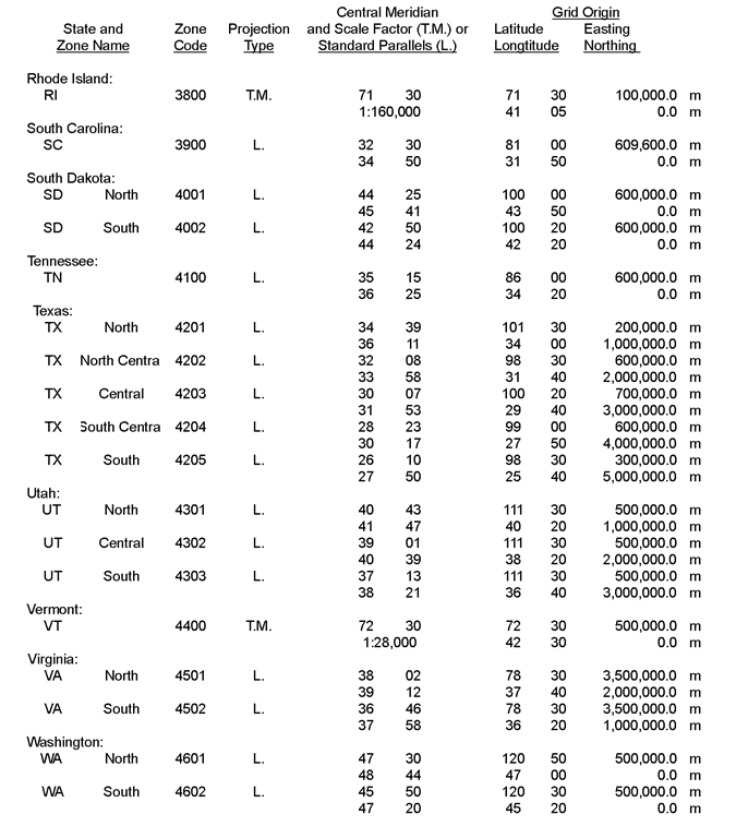
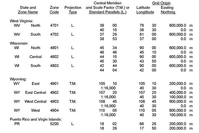
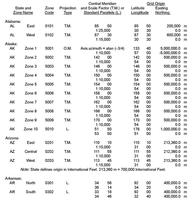
Defining Constants for the 1983 State Plane Coordinate System

Source: NOAA Manual NOS NGS 5, State Plane Coordinate System of 1983.

Abbreviations for projection types:    (T.M.) = transverse Mercator

                                                             (o.M.) = oblique Mercator

                                                             (L.) = Lambert conic conformal

Latitudes and longitudes are given as DD MM, and all longitudes are given as west longitudes.
 

Defining Constants for the 1983 State Plane Coordinate System


Defining Constants for the 1983 State Plane Coordinate System


Defining Constants for the 1983 State Plane Coordinate System


Defining Constants for the 1983 State Plane Coordinate System


Defining Constants for the 1983 State Plane Coordinate System


Defining Constants for the 1983 State Plane Coordinate System


tmp7004-167

Next post:

Previous post: