On July 4, 1997, Mars Pathfinder landed safely on the surface of Mars. Designed under the new ”faster, cheaper, and better” Discovery program philosophy, the lander deployed and navigated a small rover named “Sojourner” onto the Ares Valles landing site and began collecting data from its onboard scientific instruments. Designed primarily as an entry, descent and landing demonstration, Pathfinder returned 2.3 billion bits of new data, including over 17,000 images, 16 chemical analyses of rocks and soil, and 8.5 million individual temperature, pressure and wind measurements. Sojourner traversed approximately 100 meters (330 feet) clockwise around the lander exploring about 200 square meters (2,153 square feet) of area. See Fig. 1. The mission captured the imagination of the public, garnered front page headlines during the first week of mission operations, and went on to became one of NASA’s most popular missions. A total of about 56.6 million people visited the Pathfinder Web Pages during the first month of the mission, with 4.7 million people visiting the Web Pages on July 8, 1997 alone, making the Pathfinder landing by far the largest Internet event in history up to that time.
Mission Summary. The Mars Pathfinder mission was the second mission launched under the National Aeronautics and Space Administration’s (NASA) Discovery Program. The Discovery missions were developed for small planetary missions with a maximum three-year development cycle and a cost cap of $150 million (Fiscal Year 1992) for development that focused on engineering, science, and technology objectives. Originally conceived as an engineering demonstration of key technologies and concepts for use in future missions to Mars, the primary objective was to demonstrate a low-cost cruise, entry, descent, and landing system that could safely place a variety of science instruments on the surface of Mars. For Pathfinder, the cost of the mission was $171 million (Fiscal Year 1996),the Delta II launch vehicle was an additional $55 million, the development and operations of the rover cost an additional $25 million, and $14 million was allotted for operations.
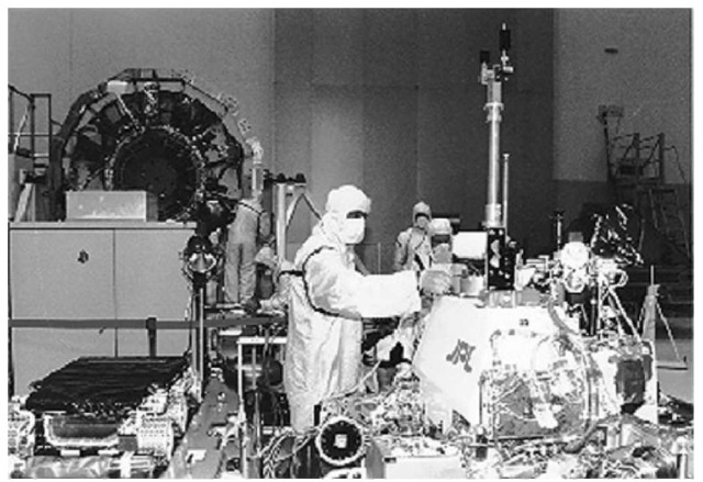
Figure 1. Mars Pathfinder, rover, and cruise stage being unpacked at the Kennedy Space Center.
Mission and Spacecraft Overview
The Pathfinder spacecraft or flight system consisted of three major components: the cruise stage, the entry decent subsystem, and the lander, which consisted of the science instruments and the rover.
Cruise Phase. The cruise phase of the Mars Pathfinder mission began with the successful launch atop a Delta II rocket from the Kennedy Space Center in Florida on December 4, 1996. See Fig. 2. Once in earth orbit, the spacecraft was given a final boost with the help of a solid-fuel rocket motor called a Payload Assist Module (PAM-D). This ‘kick-stage’ gave the spacecraft just the right amount of velocity increase it needed to escape Earth’s gravity and enter its own orbit around the Sun. Once spent, the third stage was jettisoned.
At separation from the upper stage, the spacecraft was in Earth’s shadow and spinning at 20rpm. An onboard sequence of events was activated once the separation microswitch detected the separation. The Deep Space Network (DSN) initiated spacecraft acquisition and lockup activities using a 34-meter (112-foot) antenna located in the California desert. (See Deep Space Network,Evolution of Technology). As soon as acquisition occurred, the engineering telemetry broadcast by the spacecraft was received on the ground at a rate of 40 bits per second (b/s). This telemetry consisted of a combination of real time engineering data and stored data from launch, separation, and Earth/Sun acquisition. See Fig. 3.
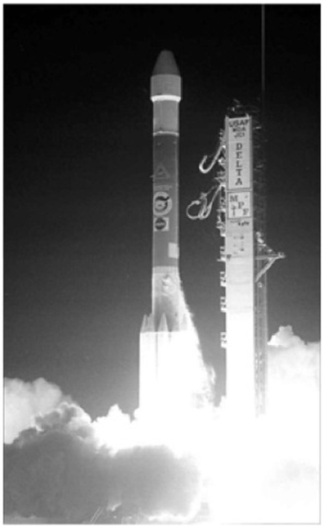
Figure 2. Mars Pathfinder launch onboard a Delta II on December 4, 1996.
The spacecraft automatically determines its orientation in space by first determining the location of the Sun with respect to the spin axis of the spacecraft using a Sun sensor located on the top of the cruise stage. This procedure, known as Sun acquisition, was supposed to provide the spacecraft with the information it needed to reduce the spin rate from 20 rpm to a nominal 2 rpm. But due to some difficulties during launch, it was soon discovered that two of the five sensors had been damaged with an unknown, foreign substance. A software patch was developed which corrected the problem and by using the data from the three working sensors, engineers were able to slow the spacecraft down. Once the spacecraft had cleared the Moon’s orbit and safely spun down to 2 rpm, the star scanner was activated. After star identification had been confirmed, the Attitude and Information Management (AIM) computer calculated the spacecraft’s orientation and position, and started its seven-month trip to Mars.
Mars Pathfinder used an Earth-Mars transfer orbit. The total flight time from Earth to Mars took seven months. See Fig. 4 for a view of the interplanetary trajectory, as it would look from above the Sun. During the seven-month cruise to Mars, a number of activities were performed to maintain the health of the entry vehicle, lander and rover. Navigation was required to maintain the flight path,and the various spacecraft subsystems were monitored and adjusted as needed to keep them operating at peak efficiency.
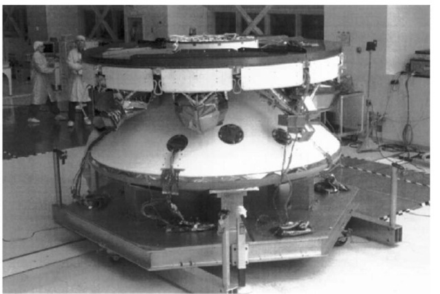
Figure 3. Mars Pathfinder in cruise configuration. The red panels are the solar cells that will supply power during the seven month cruise.
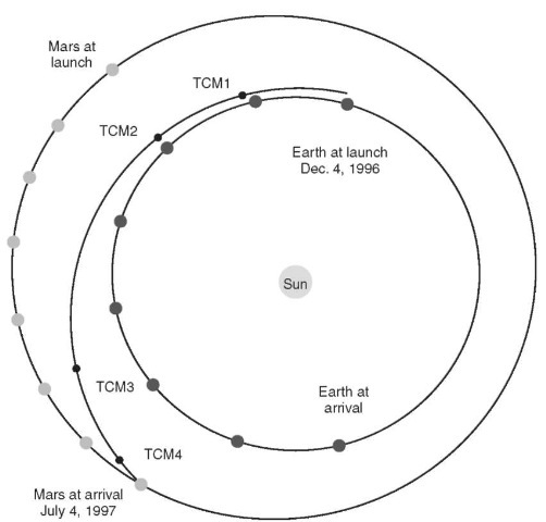
Figure 4. Mars Pathfinder cruise trajectory.
Cruise activities began once the spacecraft was safely out of Earth orbit. After the attitude was established and the spacecraft was determined to be healthy, the flight team began a two-week initial characterization and calibration period. Systems included the solar array and battery, thermal control, attitude determination and control, and the communication subsystems. The primary spacecraft activities during the first month of cruise were to collect and downlink relevant engineering telemetry and tracking data, initial spacecraft health checks and calibrations, and attitude maneuvers to maintain the correct Earth/ Sun geometry. One health check of the Rover and Science Instruments occurred on December 19, 1996.
Measurements of the spacecraft range to Earth and the rate of change of this distance were collected during every DSN station contact and sent to the navigation specialists of the flight team for analysis. They used this data to determine the true path the spacecraft was flying, and to determine corrective maneuvers needed to maintain the desired trajectory. The first of four Trajectory Correction Maneuvers (TCMs) was scheduled on January 4, 1997 to correct any errors collected from launch. The magnitude of this maneuver was less than 75 meters (246 feet) per second. Navigation was an ongoing activity that continued until the spacecraft entered the atmosphere of Mars on the 4th of July.
After TCM-1, the flight team transitioned from a ”spacecraft checkout mode” to a more routine ”spacecraft monitoring mode”. DSN tracking coverage was reduced from three contacts a day to three per week to allow other spacecraft like Mars Global Surveyor and Galileo to use the DSN time. Spacecraft health and performance telemetry was downlinked at 40b/s or greater during each tracking pass.
A key activity that took place during cruise was the designing and building of command sequences that dictated to the spacecraft how it was to perform each of the activities required. Each cruise command sequence was generated and tested, and then uplinked approximately once every four weeks during one of the regularly scheduled DSN passes. The uplink generation process required 14 days for planning, sequence generation, verification, and commanding.
Two more trajectory correction maneuvers were performed in early February and early May to further reduce any navigation guidance errors. TCM-2 required less than 10 meters (33 feet) per second, and TCM-3 was smaller still, less than 1 meter (3.3 feet) per second. These two maneuvers further reduced any guidance error detected from navigation measurements during cruise.
Starting 45 days prior to entry, tracking was increased to three passes a day and the flight team stepped up its preparation for atmosphere entry and landing. A final health and status check of the instruments and rover was performed on June 4, 1997. A fourth and final trim maneuver was performed on June 24, requiring less than 0.50 meters (1.65 feet) per second due to the accuracy of the previous maneuvers. On June 30, the spacecraft performed a turn to the entry attitude, where it remained until atmosphere entry. The roll thrusters increased the spacecraft spin rate from 2 to 10 rpm for entry. At that time, the cruise phase ended and the flight team transitioned to the entry, landing, and surface operations phases. See Fig. 5.
During the final day of approach, the navigation team produced orbit solutions on a regular basis, and adjustments were made to the computer programs that determine when the parachute should be deployed. At 6 hours out, the final adjustments were made, and the flight team made final preparations for atmosphere entry.
Entry, Decent, and Landing Phase. The fast-paced approach of Pathfinder to Mars began with venting of the heat rejection system’s cooling fluid about 90 minutes prior to landing. See Fig. 6. This fluid is circulated around the cruise stage perimeter and into the lander to keep the lander and rover cool during the seven month cruise phase of the mission. Its mission fulfilled, the cruise stage was then jettisoned from the entry vehicle about one-half hour prior to landing at a distance of 8,500 kilometers (5,100 miles) from the surface of Mars. Several minutes before landing, the spacecraft began to enter the outer fringes of the atmosphere about 125 kilometers (75 miles) above the surface. Spin stabilized at 2 rpm, and traveling at 7.5 kilometers (4.5 miles) per second the vehicle entered the atmosphere at a shallow 14.8-degree angle. A shallower entry angle would result in the vehicle skipping off the atmosphere, while a steeper entry would not provide sufficient time to accomplish all of the entry, descent and landing tasks. A Viking -derived aeroshell (including the heatshield) protected the lander from the intense heat of entry. At the point of peak heating the heatshield absorbed more than 100 megawatts of thermal energy. The Martian atmosphere slowed the vehicle from 7.5 kilometers per second to only 400 meters per second (900 miles per hour).
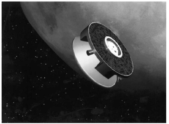
Figure 5. Artist renditions of Mars Pathfinder as it enters the Martian atmosphere.
Entry deceleration of up to 20 gees, detected by on-board accelerometers, set in motion a sequence of preprogrammed events that are completed in relatively quick succession. Deployment of the single, 8-meter (24-foot) diameter parachute occurred 2 minutes and 14 seconds after atmospheric entry at an altitude of 9.4 kilometers (6 miles) above the surface. The parachute was similar in design to those used for the Viking program but had a wider band around the perimeter, which helped to minimize swinging.
The heatshield was pyrotechnically separated from the lander 20 seconds later and dropped away. See Fig. 7. The lander soon begins to separate from the backshell and “rappels” down a metal tape on a centrifugal braking system built into one of the lander petals.
The slow descent down the metal tape places the lander into position at the end of a braided Kevlar tether, or bridle, without off-loading the parachute or placing excessive loads on the backshell. The 20-meter (66-foot) bridle provides space for airbag deployment, distance from the solid rocket motor exhaust stream and increased stability. Once the lander was lowered into position at the end of the bridle, the radar altimeter was activated and began a timing sequence for airbag inflation, backshell rocket firing and the cutting of the Kevlar bridle.
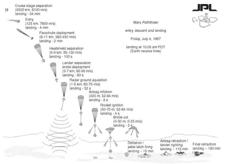
Figure 6. Entry, decent, and landing schematic for July 4, 1997.
The lander’s Honeywell radar altimeter acquired the surface about 28 seconds prior to landing at an altitude of about 1.6 kilometers (1 mile). The airbags were inflated 18 seconds later before landing at an altitude of 355 meters (less than 1/4 of a mile) above the surface. See Fig. 8. The airbags had two pyro firings, the first of which cut the tie cords and loosened the bags. The second firing, 0.25 seconds later, and 4 seconds before the rockets fired, ignited three gas generators that inflated the three 5.2-meter (17-foot) diameter bags to a little less than 1 psi. in less than 0.3 seconds.
The conical backshell above the lander contains three solid rocket motors each providing about a ton of force for over 2 seconds. The computer in the lander activates them. Electrical wires that run up the bridle close relays in the back-shell which ignite the three rockets at the same instant.
The brief firing of the solid rocket motors at an altitude of 98 meters (323 feet) was intended to essentially bring the downward movement of the lander to a halt some 12 meters, + /-10 meters (40 feet, + /-30 feet) above the surface. In reality, the rockets fired approximately 21 meters (69 feet) above the surface. The bridle separating the lander and heatshield were then cut from the lander, resulting in the backshell driving up and into the parachute under the residual impulse of the rockets, while the lander, encased in airbags, fell to the surface. See Fig. 9.
Because it was possible that the backshell could be at a small angle at the moment that the rockets fire, the rocket impulse imparted a large lateral velocity to the lander/airbag combination. In fact the impact could have been as high as 25 meters per second (56 mph) at a 30-degree grazing angle with the terrain. It was expected that the lander could have bounced at least 12 meters (40 feet) above the ground and soared 100 to 200 meters (330 to 660 feet) between bounces. Tests of the airbag system verified that it was capable of much higher impacts and longer bounces. In reality, an onboard instrument calculated at least 15 bounces with the first bounce up to 12 meters (40 feet) high without any airbag rupture.
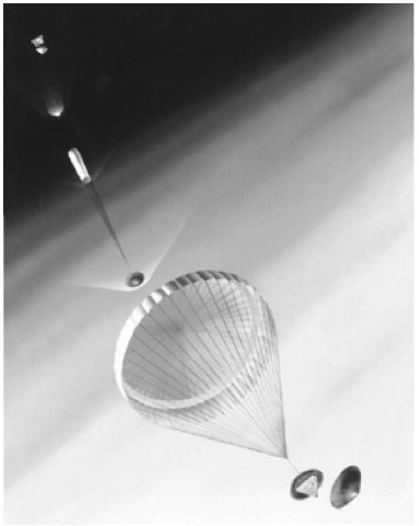
Figure 7. Artist rendition of Pathfinder entering the Martian atmosphere.
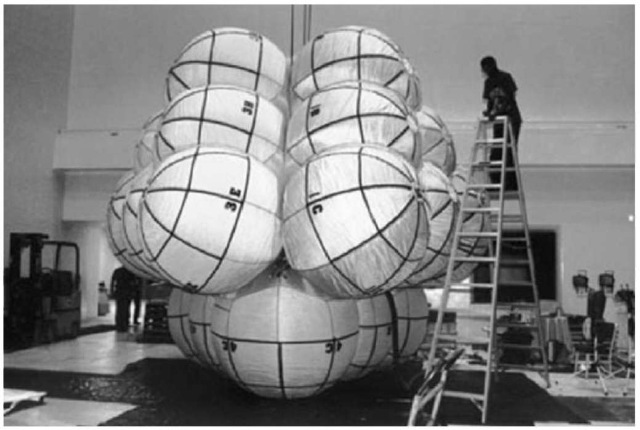
Figure 8. One of the many airbag test performed prior to lift-off. Each lobe of the airbags consists of six spheres, with four lobes, one for each of the pedals. The airbags total 16 feet from the ground to the top.
Once the lander had settled on the surface, pyrotechnic devices in the lander petal latches were blown to allow the petals to be opened. The latches locking the sturdy side petals in place were necessary because of the pulling forces exerted on the lander petals by the deployed airbag system. In parallel with the petal latch release, a retraction system began slowly dragging the air-bags toward the lander, breaching vent ports on the side of each bag, in the process deflating the bags through a cloth filter. The airbags were drawn toward the petals by internal lines extending between attachments within the airbags and small winches on each of the lander sides. It took about 64 minutes to deflate and fully retract the bags. See Fig. 10.
There is one high-torque motor on each of the three petal hinges. If the lander had come to rest on its side, it would have to be righted to the base petal by opening a side petal with a motor drive to place the lander in an upright position. Once upright, the other two remaining petals would have been opened.
About three hours was allotted to retract the airbags and deploy the lander petals, but on Mars the whole operation only took 87 minutes because Pathfinder came to rest on the base petal. At this time, the lander’s X-band radio transmitter was turned off for the first time since before it was launched on December 4, 1996.
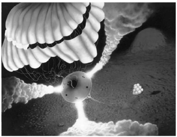
Figure 9. Artist renditions of the landing of Mars Pathfinder on the surface of Mars.
This saved battery power and allowed the transmitter electronics to cool down after being warmed up during entry without the cooling system. It also allowed time for the Earth to rise well above the local horizon so that it would be in a better position for communications with the lander’s low-gain antenna.
Science Instruments and Objectives
The Mars Pathfinder project landed a single vehicle on the surface of Mars, which included a microrover, (Sojourner), and several science instruments. See Fig. 11. Sojourner’s mobility provided the capability of ”ground truthing” the local landing area and investigating the surface with three additional science instruments: A stereoscopic imager with spectral filters on an extendible mast (IMP), an Alpha Proton X-Ray Spectrometer (APXS), and an Atmospheric Structure Instrument/Meteorology package (ASI/MET). See Fig. 12. These instruments allowed for investigations of the geology and surface morphology at submeter to a hundred meters scale, the geochemistry and petrology of soils and rocks, the magnetic and mechanical properties of the soil as well as the magnetic properties of the dust, a variety of atmospheric investigations and rotational and orbital dynamics of Mars.
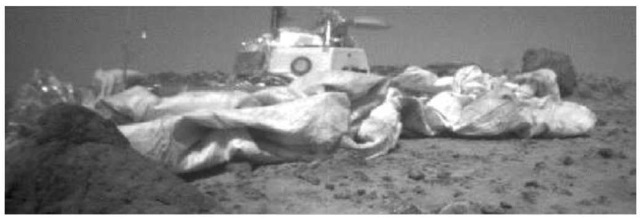
Figure 10. Rover view of the lander on the surface of Mars. Notice how far the airbags retracted.
Landing downstream from the mouth of a giant catastrophic outflow channel (Ares Vales) offered the potential for identifying and analyzing a wide variety of materials in the crust, from the ancient heavily cratered terrain to intermediate-aged ridged plains to reworked channel deposits. Examination of the different surface materials allowed first-order scientific investigations of the early differentiation and evolution of the crust, the development of weathering products and the early environments and conditions that have existed on Mars.
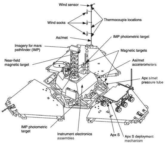
Figure 11. Computer drawing of the lander components.
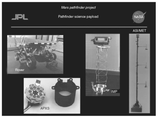
Figure 12. Mars Pathfinder instrument package. Imager for Mars Pathfinder (IMP), Alpha Proton X-Ray Spectrometer (APXS), an Atmospheric/Meteorology. (ASIMET.)
Surface Morphology and Geology at Meter Scale. The Imager for Mars Pathfinder (IMP) examined Martian geologic processes and surface-atmosphere interactions similar to what was observed at the Viking landing sites. See Fig. 13. Observations of the general landscape, surface slopes and the distribution of rocks were obtained by panoramic stereo images at various times of the day. IMP was also designed to monitor any dust or sand deposition, erosion or other surface-atmosphere interactions. A basic understanding of the surface and near-surface soil properties was obtained by the rover and lander imaging of rover wheel tracks, holes dug by rover wheels, and examining any surface disruptions caused by airbag bounces or retractions.
Petrology and Geochemistry of Surface Materials. The Alpha-Proton X-Ray Spectrometer (APXS) and the visible to near-infrared spectral filters on the IMP determined the dominant elements that made up the rocks and other surface materials of the landing site. A better understanding of these materials provided answers concerning the composition of the Martian crust, and secondary weathering products (such as different types of soils). These investigations provided a calibration point for orbital remote sensing observations such as Mars Global Surveyor. The IMP was able to obtain full multi-spectral panoramas of the surface and underlying materials exposed by the rover.
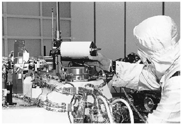
Figure 13. Figure 7 Imager for Mars Pathfinder (IMP) being tested before launch.
Magnetic Properties and Soil Mechanics of the Surface.
Magnetic targets were distributed at various points around the spacecraft. Multi-spectral images of these targets identified the magnetic minerals that make up the airborne dust. Using the IMP images, it was possible to identify the mineral composition of the rocks. Detailed examination of the wheel-track images also gave a better understanding of the mechanics of the soil surrounding the landing site.
Atmospheric Structure as Well as Diurnal and Seasonal Meteorological Variations. The Atmospheric Structure Instrument/Meteorology (ASI/MET) experiment was able to monitor the temperature and density of the atmosphere during Entry, Descent and Landing (EDL). In addition, three-axis accelerometers were used to measure atmospheric pressure during entry. Once on the surface, meteorological measurements such as pressure, temperature, wind speed and atmospheric opacity were obtained on a daily basis. Thermocouples mounted on a one meter (3.3 foot) high mast examined temperature profile with height. Wind direction and speed were measured by a wind sensor mounted at the top of the mast, as well as three windsocks interspersed at different heights on the mast. Understanding this data was important for identifying the forces that act on small particles carried by the wind. Regular sky and solar spectral observations using the IMP monitored windborne particle size, particle shape, distribution with altitude and the abundance of water vapor.
Rotational and Orbital Dynamics of Mars. The Deep Space Network (DSN), by using two-way X-Band and Doppler tracking of the Mars Pathfinder lander once it was on the surface, was able to address a variety of orbital and rotational dynamics questions. Spacecraft ranging involves sending a code to the lander and measuring the time required for the lander to echo the code back to the Earth-based station. By dividing this time by the speed of light, results can be accurate within 1 to 5 meters (3 to 16 feet) of the distance from the station to the spacecraft. As the lander moves relative to the tracking station, the velocity between the spacecraft and Earth causes a Doppler shift in frequency. Measuring this frequency shift provided an accurate measurement of the distance from the station to the lander. After a few months of observing these features, the Mars Pathfinder lander location was determined within a few meters. Once the exact location of Pathfinder had been identified, the orientation and precession rate of the pole can be calculated and compared to measurements made with the Viking landers 20 years ago. Measurement of the precession rate allowed direct calculation for the moment of inertia. Measurements similar to these are used on earth to determine the makeup of the earth’s interior.
Surface Science Phase. After receiving data indicating the health of the spacecraft and a successful landing, commands were sent to the spacecraft to unlatch the IMP camera and the high gain antenna. The first task of the lander was to determine the location of the Sun. To do this, the IMP scanned the horizon for the brightest spot on the horizon. Once the Sun’s location was determined, the high gain antenna was directed towards Earth and the first images were received around 4:30 p.m. PDT. The first received data included the mission success panorama, stereo images of both rover ramps, and spacecraft engineering data which included the health status of the spacecraft and the status of the airbag retraction. See Fig. 14.
After examining the imagery, it was determined that the airbags had not fully retracted from the rover petal and that it would not be safe to deploy the rover petals. Commands were sent up to reclose the rover petal, retract the airbag further, and then redeploy the rover petal. After careful examination of a second set of images, the ramps were determined to be safe and the rover was commanded to stand up. A full panorama of the landing site was also returned on the first day of operation and the rover was driven down the rear ramp the following day (Sol 2). After it was determined to be safe to deploy the IMP camera, the camera mast was deployed to a height of 0.8 meters (2.6 feet) at the end of Sol 2. After some minor communication errors between the rover modem and the lander, the rover deployed the APXS at the surface for its first soil sample. See Fig. 15.
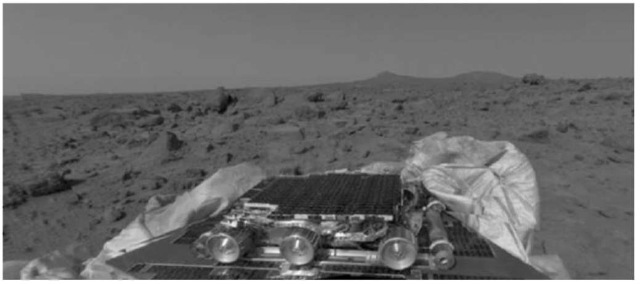
Figure 14. Mission success panorama acquired on July 4, 1997.
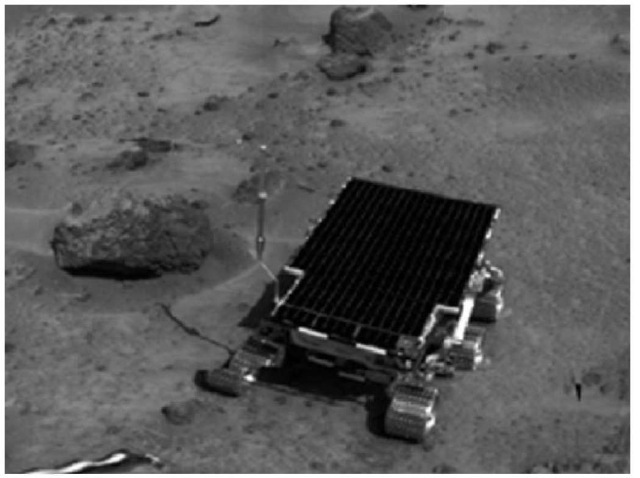
Figure 15. Sojourner on the surface of Mars. Rock to the left is Barnacle Bill.
Lander Site Location
When the first images had arrived, five prominent horizon features and two small craters were identified in both lander horizon and Viking Orbiter images. This enabled the lander to be located within 100 meters (330 feet) of other surface features at 19.13 °N, 33.22 °W in the U.S. Geological Survey reference frame.
Characteristics of the landing site were determined to be consistent with its prelanding predication of a flat, level flood plain composed primarily of materials left behind by the Tiu and Ares catastrophic floods. The surface is composed of pebbles, cobbles and boulders that closely resemble depositional surfaces found from catastrophic floods on Earth. Two nearby peaks identified as ”Twin Peaks,” appear to be streamlined hills in IMP images; this is consistent with prelanding predictions of Viking Orbiter images of the region. Rocks identified in the Rock Garden are imbricated in the direction of the predicted flow; again agreeing with prelanding predictions Troughs are also visible throughout the scene and have been interpreted to be erosional features produced by the turbulent flood waters. Large boulders can be found perched on top of smaller rocks (i.e. Yogi), consistent with deposition by a flood. Except for later eolian activity, the site appears little altered since it formed up to a few billion years ago.
A variety of soil types have also been identified at the Pathfinder landing site. See Fig. 16. These soils appear to be composed of poorly crystalline ferric-bearing materials. Elemental compositions of soil units measured by the APXS are similar in composition to those measured at both of the Viking landing sites. Due to the distance between the Pathfinder site and the two Viking landing sites, the similarities in soil compositions suggest that the compositions are influenced by globally distributed airborne dust.
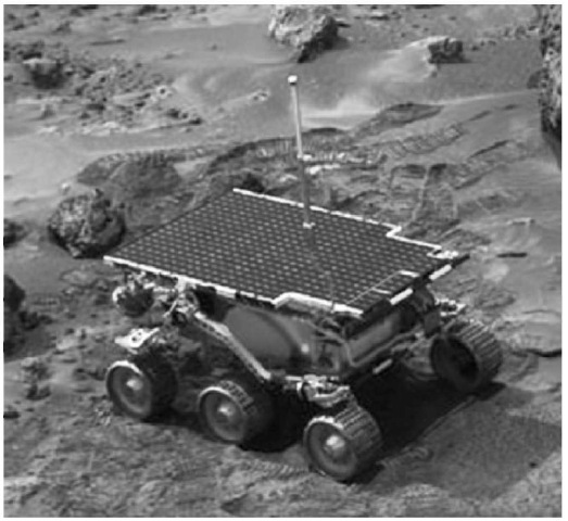
Figure 16. End of day image of the rover.
Rocks that have been identified at the Pathfinder site are primarily dark gray and partially covered with coatings of bright dust and/or weathered surfaces. See Fig. 17. From the rock chemistry measured by the APXS they appear to be similar to basalt, basaltic andesites, and andesites found on Earth. Rover close-up and IMP images display rocks with a variety of different morphologies, textures and fabrics. Some of the rocks have been hypothesized to be conglomerates composed of rounded pebbles embedded in a finer matrix. Rocks such as these may be the source of numerous rounded pebbles and cobbles that were identified throughout the site. If these rocks are conglomerates, their formation suggests that running water was present to smooth and round the pebbles and cobbles over long periods of time. The rounded materials would then be deposited into a finer grained sand and clay matrix and lithified before being carried to the Ares site. This suggests a warmer and wetter past in which liquid water was stable on the surface.
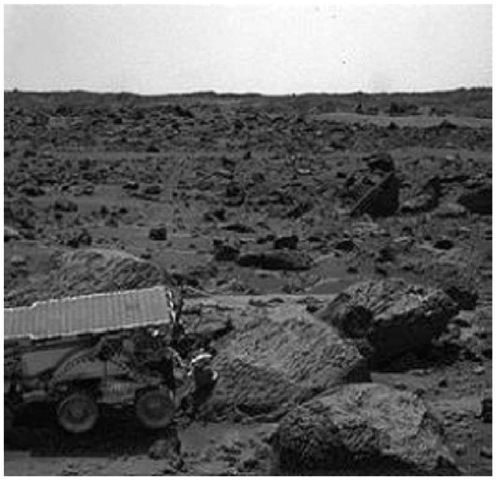
Figure 17. End of day IMP image of the rover in the Rock Garden.
The magnetic properties experiment identified the airborne magnetic dust that was deposited on most of the magnetic targets. The dust is characterized as a light yellowish brown, with clay-sized silicate particles and a small amount of a magnetic mineral (believed to be maghemite). The present interpretation for the maghemite formation is that iron was dissolved out of crystal materials by water and that the maghemite is a freeze-dried secondary precipitate.
Observations from wheel tracks and soil mechanics experiments illustrate that the subsurface consisted of a variety of different materials with different physical properties. See Fig. 18. Rover tracks observed in bright drift material preserved individual cleat indicating that they are compressible deposits of very fine-grained dust. Several cloddy deposits found at the landing site appear to be composed of poorly sorted dust, sand-sized particles, lumps of soil, and small rock granules and pebbles.
The atmospheric opacity was determined to be 0.5 and changes slightly higher at night as well as early in the morning due to clouds. The sky is a light yellowish brown color composed of micron-sized particles and water vapor. See Fig. 19. The upper atmosphere, above 60 kilometers (36 miles) altitude, was determined to be very cold and different from warmer measurements obtained by both Viking landers. The differences in the measurements obtained by both Viking landers may be attributed to seasonal variations at the time of landing. The multiple peaks in the landed pressure measurements and the entry and descent data are indicative of dust uniformly mixed in a warm lower atmosphere.
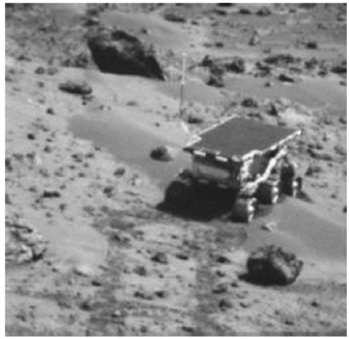
Figure 18. Rover on Merimaid Dune.
The meteorology measurements at the site identified diurnal and higher order temperature fluctuations. The barometric minimum was reached at the site of Sol 20 indicating the maximum extent of the winter south polar cap. Temperatures changed abruptly with time and height in the morning; these observations suggest that the warming of the cold morning air by the Sun created upward moving small eddies. Winds were fairly consistent, and dust devils were detected repeatedly throughout the mission.
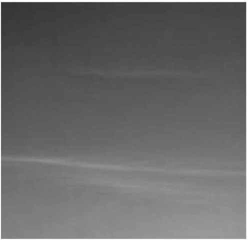
Figure 19. Clouds observed at the Ares Valles landing site.
Daily Doppler tracking and less frequent two-way ranging during communication sessions between the spacecraft and Deep Space Network antennas resulted in a solution for the location of the lander and the direction of the Mars rotation axis. Combined with earlier results from the Viking landers, the estimated precession constant constrains the core radius or Mars to be between 1,300 and 2,000 kilometers (780 to 1200 miles).
From all of the scientific results that have been completed so far, early Mars appears to have been very similar to an early Earth. Some of the materials that make up the crust may be similar to terrestrial continental crust materials. The rounded pebbles, cobbles suggest a possible conglomerate, which supports water rich early Mars. This would imply that the early environment of Mars was warmer and wetter than today and liquid water may have been in equilibrium. Further Mars missions may be able to answer these questions.
