The invention: A series of cloud-cover meteorological satellites that pioneered the reconnaissance of large-scale weather systems and led to vast improvements in weather forecasting.
The person behind the invention:
Harry Wexler (1911-1962), director of National Weather Bureau meteorological research
Cameras in Space
The first experimental weather satellite, Tiros 1, was launched from Cape Canaveral on April 1, 1960. Tiros’s orbit was angled to cover the area from Montreal, Canada, to Santa Cruz, Argentina, in the Western Hemisphere. Tiros completed an orbit every ninety-nine minutes and, when launched, was expected to survive at least three months in space, returning thousands of images of large-scale weather systems.
Tiros 1 was equipped with a pair of vidicon scanner television cameras, one equipped with a wide-angle lens and the other with a narrow-angle lens. Both cameras created pictures with five hundred lines per frame at a shutter speed of 1.5 milliseconds. Each television camera’s imaging data were stored on magnetic tape for downloading to ground stations when Tiros 1 was in range. The wide-angle lens provided a low-resolution view of an area covering 2,048 square kilometers. The narrow-angle lens had a resolution of half a kilometer within a viewing area of 205 square kilometers.
Tiros transmitted its data to ground stations, which displayed the data on television screens. Photographs of these displays were then made for permanent records. Tiros weather data were sent to the Naval Photographic Interpretation Center for detailed meteorological analysis. Next, the photographs were passed along to the National Weather Bureau for further study.
Tiros caused some controversy because it was able to image large areas of the communist world: the Soviet Union, Cuba, and Mongolia. The weather satellite’s imaging system was not, however, partic-

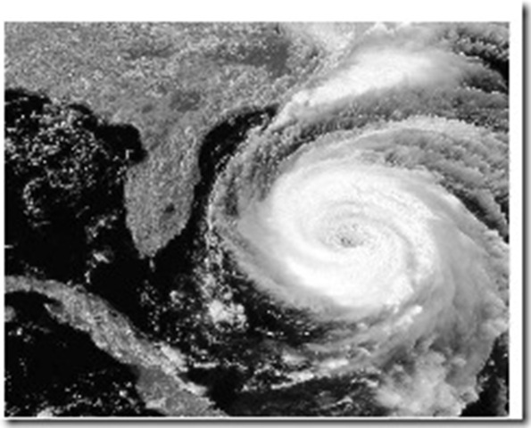
Hurricane off the coast of Florida photographed from space. (PhotoDisc)
ularly useful as a spy satellite, and only large-scale surface features were visible in the images. Nevertheless, the National Aeronautics and Space Administration (NASA) skirted adverse international reactions by carefully scrutinizing Tiros’s images for evidence of sensitive surface features before releasing them publicly.
A Startling Discovery
Tiros 1 was not in orbit very long before it made a significant and startling discovery. It was the first satellite to document that large storms have vortex patterns that resemble whirling pinwheels. Within its lifetime, Tiros photographed more than forty northern mid-latitude storm systems, and each one had a vortex at its center. These storms were in various stages of development and were between 800 and 1,600 kilometers in diameter. The storm vortex in most of these was located inside a 560-kilometer-diameter circle around the center of the storm’s low-pressure zone. Nevertheless, Tiros’s images did not reveal at what stage in a storm’s development the vortex pattern formed.
This was typical of Tiros’s data. The satellite was truly an experiment, and, as is the case with most initial experiments, various new phenomena were uncovered but were not fully understood. The data showed clearly that weather systems could be investigated from orbit and that future weather satellites could be outfitted with sensors that would lead to better understanding of meteorology on a global scale.
Tiros 1 did suffer from a few difficulties during its lifetime in orbit. Low contrast in the television imaging system often made it difficult to distinguish between cloud cover and snow cover. The magnetic tape system for the high-resolution camera failed at an early stage. Also, Earth’s magnetic field tended to move Tiros 1 away from an advantageous Earth observation attitude. Experience with Tiros 1 led to improvements in later Tiros satellites and many other weather-related satellites.
Consequences
Prior to Tiros 1, weather monitoring required networks of ground-based instrumentation centers, airborne balloons, and instrumented aircraft. Brief high-altitude rocket flights provided limited coverage of cloud systems from above. Tiros 1 was the first step in the development of the permanent monitoring of weather systems. The resulting early detection and accurate tracking of hurricanes alone have resulted in savings in both property and human life.
As a result of the Tiros 1 experiment, meteorologists were not ready to discard ground-based and airborne weather systems in favor of satellites alone. Such systems could not provide data about pressure, humidity, and temperature, for example. Tiros 1 did, however, introduce weather satellites as a necessary supplement to ground-based and airborne systems for large-scale monitoring of weather systems and storms. Satellites could provide more reliable and expansive coverage at a far lower cost than a large contingent of aircraft. Tiros 1, which was followed by nine similar spacecraft, paved the way for modern weather satellite systems.
See also Artificial satellite; Communications satellite; Cruise missile; Radio interferometer; Rocket.

