Geoscience Reference
In-Depth Information
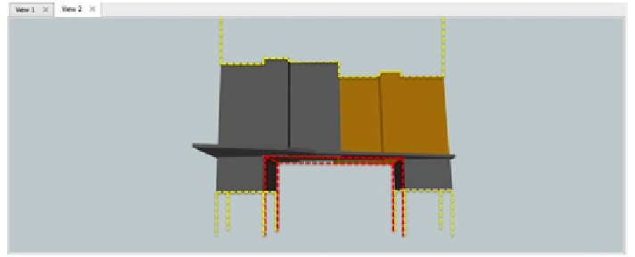
Fig. 15
Example of 3D cadastral modelling issues in case study 6: air and subterranean volume
spaces in yellow dashed lines (private domain) need to be modelled; air/subterranean volume
space in red dashed lines (public domain) constitutes an exception to the general cadastral law
and needs to be modelled too
4 Conclusions
4.1 Final Considerations
A 3D cadastral framework consists of concepts, functionalities, and techniques
within which a modern approach is typically a computer-based and multipurpose
land administration system. Three key aspects can be specified as follows: cadas-
tral surveying and mapping, legislation, and stakeholders. It is within this context
that each national/state context should be modelled based on its specific legislation
and potential stakeholders involved.
The main reasons of the need for a more sophisticated modelling approach
towards 3D cadastral systems of land registration and management may be sum-
marised as follows:
• Materialisation of legal ownership concepts within a 3D geometry structure,
particularly needed to handle exceptional 3D occurrences to the cadastral law
• 3D visualisation capabilities for both authorities and general public, particularly
of exceptional occurrences above.
After reviewing related work on property cadastre 3D modelling, Portugal's his-
torical and current property cadastre situations were revisited. Opportunities
within Portugal's context were sought by indentifying six different case studies in
which a 3D modelling approach revealed to be pertinent. Case studies were used
as the basis for development purposes of a 3D model prototype. Our first research
steps mainly focused on the three-level data modelling: conceptual, logical, and
physical. First implementation tests focused principally on technical solutions for