Geoscience Reference
In-Depth Information
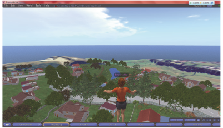
Fig. 8
An overview of the finished virtual development. The guide terrain has been replaced
with the final terrain
needed to create a 3D dwelling were then linked so that the dwelling could be
managed as a single object. The last stage is selecting textures for those complete
models, increasing the fidelity of their appearances (Zhang and Moore
2014
).
The textures were either photographs from reality (bricks, concrete) or picked from
the generic OpenSim library (roofing material). Fencing and walls to delimit the
area of planned individual housing plots were assembled using a similar workflow.
These houses, fences and walls were duplicated to fill the virtual development
plot, interspersed with landscape objects such as trees, grass and water features
on top of the grass texture chosen to drape the underlying terrain. The boundary
imprint in the terrain that had been propagated from geographic data in ArcGIS
forms the spatial constraint for the proposed development. Once all the primitive
building was complete, the augmented terrain was replaced with actual terrain
(which had been similarly processed in ArcGIS and Imagine—Fig.
3
c) to leave the
finished virtual environment. This VE has most of Döllner's (
2007
) elements and
attributes.
2.3 Testing of the GIS, CAD and Virtual Environments
Invites were sent to various urban planners, designers, surveyors and senior
students in urban design around New Zealand. Potential participants were
presented with an information sheet on the project, which detailed in overview the
tasks to be performed whilst in the three environments and themes of the ques-
tions asked in the accompanying questionnaire. Having read through this, the
approached party could either undertake the study or withdraw at any time.