Geoscience Reference
In-Depth Information
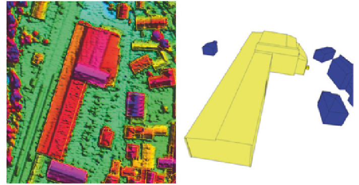
Fig. 11
Detailed calculation of the roof structure with up-to-date DSM from oriented aerial
photographs from the Bavarian photogrammetry campaign
cadastre. If the roof of a building consists of multiple roof shapes, these can be
divided using construction element creation (Aringer and Hümmer
2011
).
The cadastre in Bavaria currently does not contain such 3D-information yet.
After derivation of the standardized roofs of the 3D Building Model with the semi-
automated first data acquisition, these data can also improve the two dimensional
cadastre. So, a significant added value arises for the cadastre.
If this information should be used for updating, the challenge is that the data
need to be inversely convertible from the second dimension unambiguously to the
third dimension. If multiple roof shapes exist per building ground plan, the princi-
ple of the subdivision of buildings in components is used.
Figure
11
shows buildings with roof shapes which are divided into components
by red lines. Blue lines however represent the ridge lines of the roofs. The red
points represent ridge and eave points which are attributed as “special” building
points with a relative height specification in the cadastre. Together with the ridges
and the lines that separate the components a unique reconstruction of the roof
geometry from the cadastral two dimensional data is possible. This still needs to
be implemented programmatically in Bavaria (Fig.
12
).
After completion of the first data acquisition and the space closure, the 3D
Building Model is continually updated by the regular maintenance of the cadas-
tre in Bavaria. Then neither LiDAR-data nor a DSM from image matching are
required, since the cadastral measured building roof shapes are used. If multiple
roof shapes for a building exist, these are divided into components. Additionally
he ridge lines of a roof shape are calculated as well as the height of selected
“special” building points (ridge and eave points). With this information the third
dimension can be reconstructed afterwards and thereby the 3D Building Model
can be updated (Fig.
13
).