Geoscience Reference
In-Depth Information
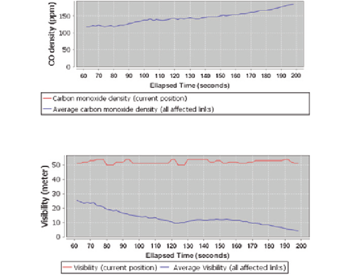
Fig. 19
Carbon monoxide density-time chart
Fig. 20
Visibility-time chart
lower than the average temperature values of all links affected by fire. Figure
18
shows that the user has been guided to the links that has no blazing fire occurrence.
Figure
19
shows that the user has never been guided through a link with carbon
monoxide. Figure
20
shows that the links that user has been guided through has
always more visibility than the average visibility of all links affected by fire.
5 Conclusions
This chapter has suggested a novel method of evacuation from buildings in case
of fire accident considering human and environment factors using Multilayer
Perceptron (MLP) network which is one of the most preferred classification
method of artificial neural networks. Our trained MLP network estimates risk lev-
els of links in the path during evacuation with a prediction accuracy of 93.8 %.
For better understanding the intelligent routing process, an evacuation simula-
tion which works integrated with MLP network has been developed and presented
in this chapter. The simulation is based on a Java based 3D-GIS implementation
which can visualize 3D building and network models from CityGML format and
perform analysis on a 3D network stored in Oracle Spatial's Network Data Model.