Geoscience Reference
In-Depth Information
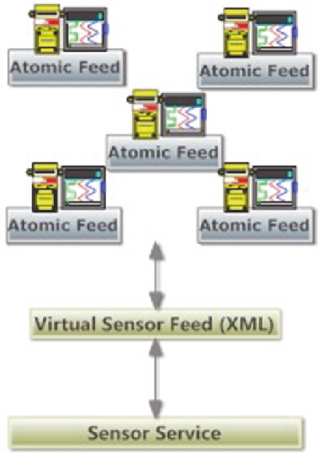
Fig. 1
Information
acquisition layer
the geospatial environment. According to the framework once the information from
the indoor sensors has been acquired, this information can be visualised together
with the 3D representations of Building Information Models, building representa-
tions in digital city models.
The Sensor Acquisition Framework concentrates on two dimensions, the first
one being defining a web service architecture for provision of sensor informa-
tion, the second one being acquisition and visualisation of this information in the
geospatial environment. There also is a third dimension as the representation of
acquired sensor information within building and indoor models, which also covers
the design of models for representation of sensor's coverage (i.e. as sensor spaces)
within the buildings.
As presented in Fig.
1
, the Information Acquisition Layer of the framework
consists of connected devices (containing sensors and embedded web servers).
These embedded web servers are able to publish lightweight XML feeds where
each contain information about a single physical value (i.e. temperature) or mul-
tiple physical values (i.e. humidity and oxygen level). A virtual sensor is a soft-
ware component that is able to collect information from other sensors, abstract and