Geoscience Reference
In-Depth Information
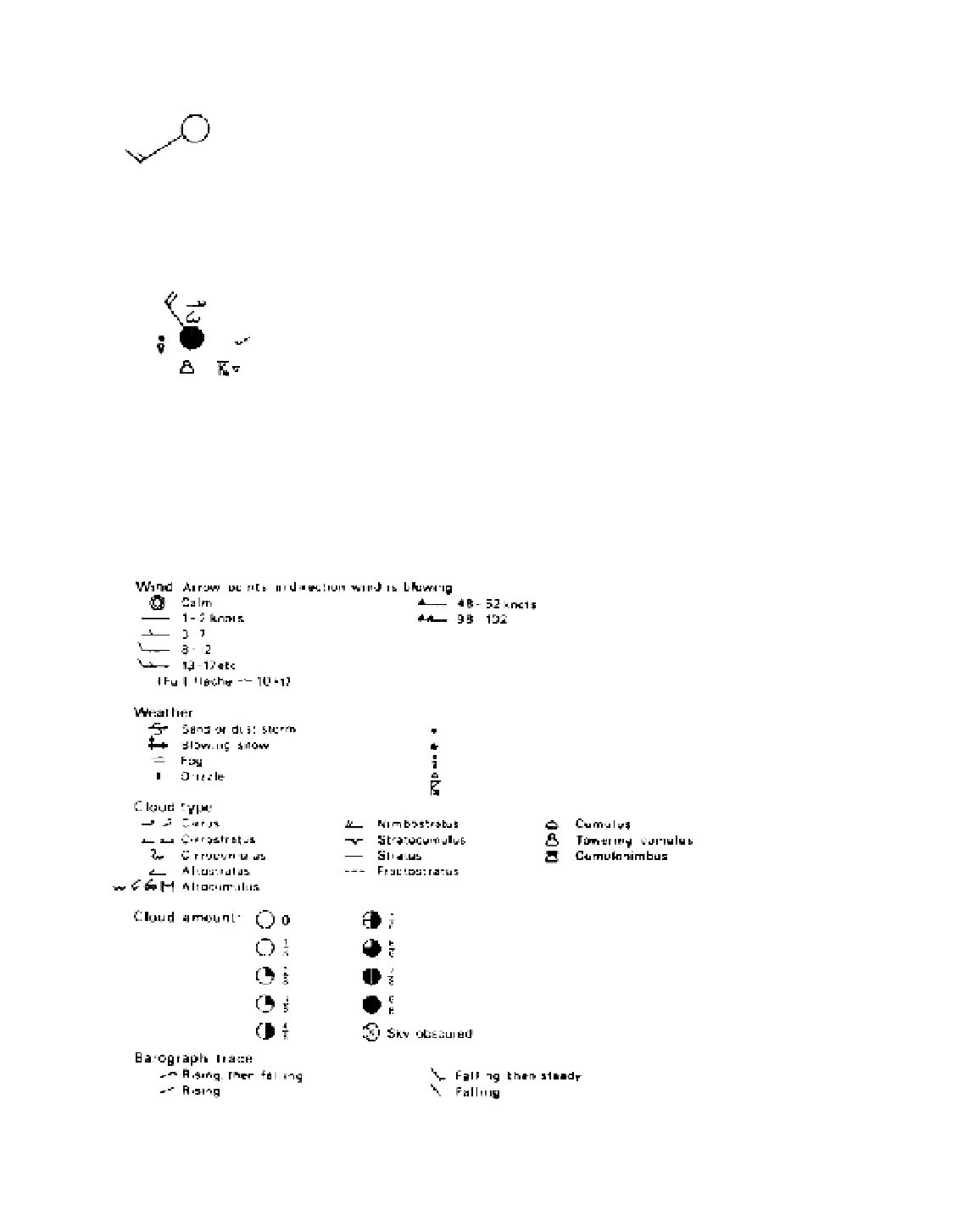
Figure A3.1
Basic station model
for plotting weather data. The key
and example are tabulated in the
internationally agreed sequence for
teletype messages. These data would
be preceded by an identifying station
number, date and time.
MODEL (enlarged)
KEY
EXAMPLE
Total cloud (oktas)
1
Wind direction (tens of degrees)
Wind speed (knots)
N
dd
ff
7
32
20
C
H
C
M
TT
VV
PPP
VV
ww
W
1
W
2
PPP
TT
Visibility (code)
Present weather (coded symbol)
Past weather (coded symbol)
“ ” “ ”
Sea-level pressure (mb)
2
Temperature (˚C)
4
66
80
9
8
105
20
ww
N
ppa
dd
C
L
W
1
W
2
ff
N
h
/
h
Td Td
Low cloud (oktas)
1
Low cloud type (coded symbol)
Height of C
L
(code)
Medium cloud type (coded symbol)
High cloud type (coded symbol)
N
h
C
L
h
C
M
C
H
4
2
3
5
2
EXAMPLE
20
66
14
105
05
Dew-point temperature (˚C)
4
Barograph trace (coded symbol)
Td Td
a
14
3
4/3
3-hour pressure change (mb)
3
pp
05
1
okta = eighth
2
Pressure in tens, units and tenths mb:
omitting initial 9 or 10 i.e. 105 = 1010
.
5
3
Pressure change in units and tenths mb
4
Rounded to nearest ˚C
Figure A3.2
Representative synoptic
symbols.
Wind Arrow points in direction wind is blowing
Calm
1-2 knots
3-7
8-12
13-17 etc
(Full fleche
48-52 knots
98-102
10 kt)
Weather:
Sand or dust storm
Blowing snow
Fog
Drizzle
Rain
Snow
Rain shower
Thunderstorm with hail
Cloud type:
Cirrus
Cirrostratus
Cirrocumulus
Altostratus
Altocumulus
Nimbostratus
Stratocumulus
Stratus
Fractostratus
Cumulus
Towering cumulus
Cumulonimbus
5
8
6
8
7
8
8
8
Cloud amount:
0
1
8
2
8
3
8
4
8
Sky obscured
Barograph trace:
Rising, then falling
Rising
Falling, then steady
Falling


