Geoscience Reference
In-Depth Information
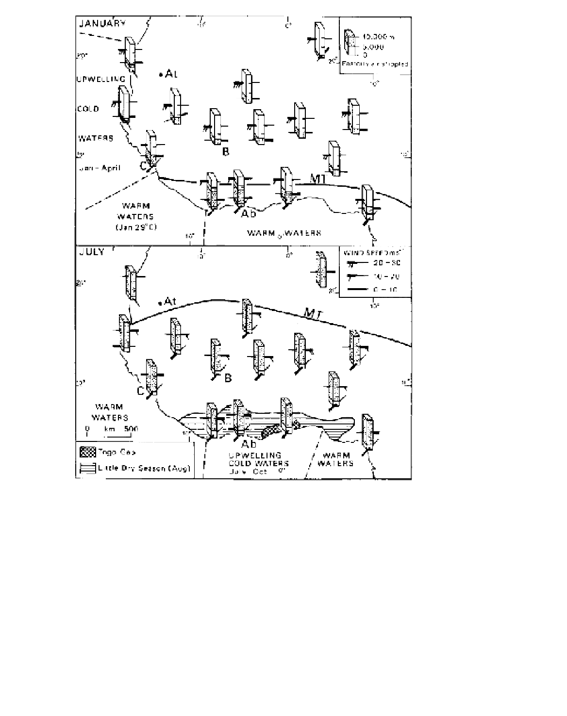
Figure 11.41
Mean wind speeds
(m s
-1
) and directions in January and
July over West Africa up to about
15,000 m. Ocean water temper-
atures and the positions of the
monsoon trough are also shown, as
are the area affected by the August
little dry season and the location of the
anomalous Togo Gap. The locations
of Abidjan (Ab), Atar (At), Bamako
(B) and Conakry (C) are given (see
precipitation graphs in Figure 11.42).
Source
: From Hayward and Oguntoyinbo
(1987).
which contribute significantly to the rainfall during this
season. Three types of perturbation are particularly
prevalent:
easterly airflows. These waves are from 1500 to 4000
km long from north to south. They move westward
across West Africa between mid-June and October
with a periodicity of three to five days and sometimes
developing closed cyclonic circulations. Their speed
is about 5 to 10° of longitude per day (i.e. 18 to
35 km hr
-1
). At the height of the summer monsoon,
they produce most rainfall at around latitude 14°N,
between 300 and 1100 km south of the monsoon
trough. On average, some fifty easterly waves per
year cross Dakar. Some of these carry on in the
general circulation across the Atlantic, and it has
been estimated that 60 per cent of West Indian hur-
ricanes originate in West Africa as easterly waves.
1
Waves in the southwesterlies
. These are northward
surges of the humid airflow with periodicities of
four to six days. They produce bands of summer
monsoon rain some 160 km broad and 50 to 80 km
in north-south extent, which have the most marked
effect 1100 to 1400 km south of the surface monsoon
trough, the position of which oscillates with the
surges.
2
Waves in the easterlies
. These develop on the inter-
face between the lower southwesterly and the upper