Geoscience Reference
In-Depth Information
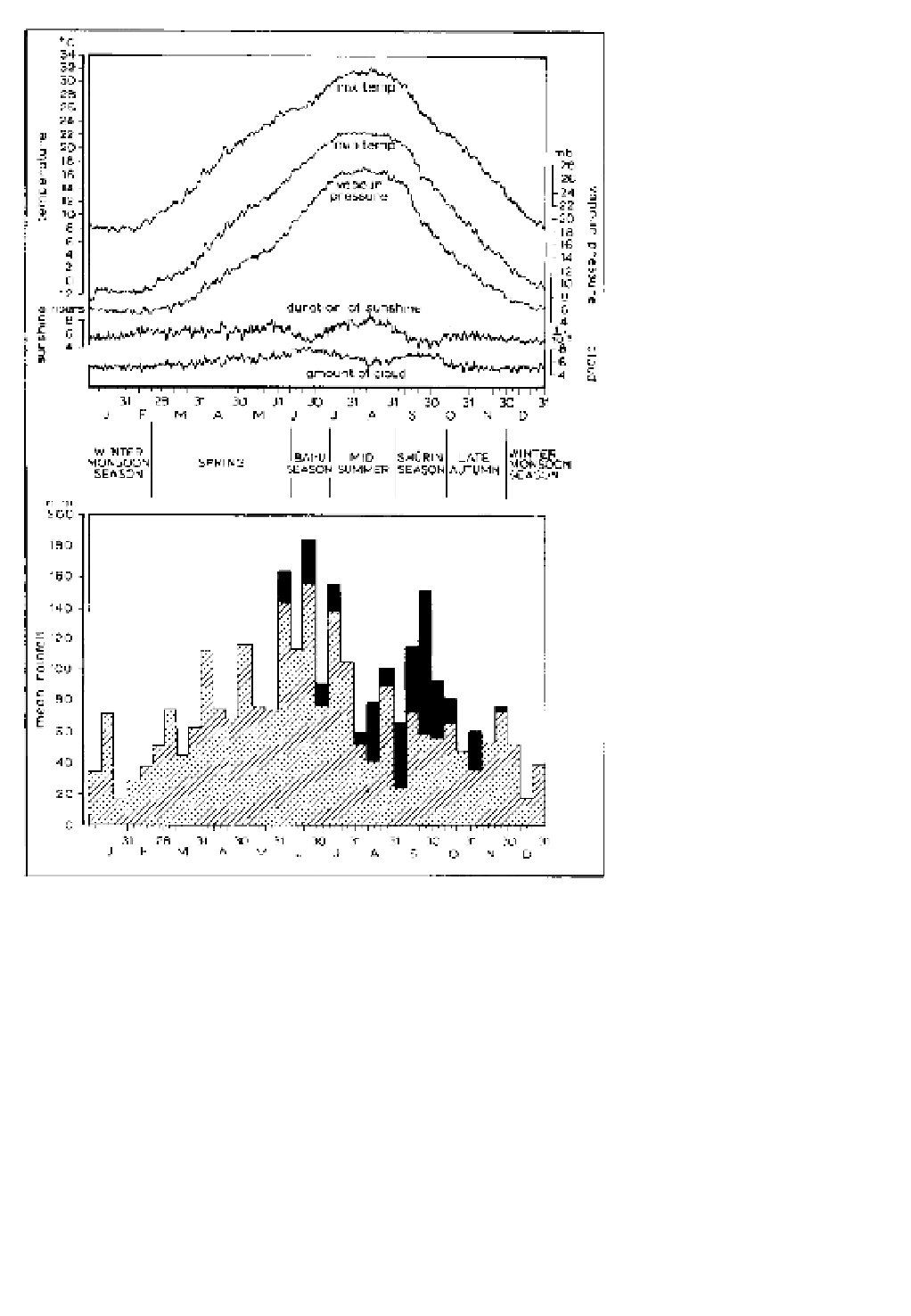
Figure 11.36
(A) Seasonal variation
of daily normals at Nagoya, southern
Japan, suggesting six natural seasons.
(B) Average ten-day precipitation
amounts for a station in southern
Japan, indicating in black the propor-
tion of rainfall produced by typhoon
circulations. The latter reaches a
maximum during the Shurin season.
Sources
: (A) From Maejima (1967);
(B) after Saito (1959), from Trewartha
(1981).
A
B
during late July and August, giving a period of more
settled sunny weather. The secondary precipitation
maximum of the Shurin season during September and
early October coincides with an eastward contraction
of the Pacific subtropical anticyclone, allowing low-
pressure systems and typhoons from the Pacific to
swing north towards Japan. Although much of the
Shurin rainfall is believed to be of typhoon origin (see
Figure 11.36), some is undoubtedly associated with
the southern sides of depressions moving along the
southward-migrating Pacific polar front to the north (see
Figures 11.22 and 11.35), because there is a marked
tendency for the autumn rains to begin first in the north
of Japan and to spread southwards. The manner in which
the location of the western margin of the North Pacific
subtropical high-pressure cell affects the climates of
China and Japan is well illustrated by the changing
seasonal trajectories of typhoon paths over East Asia
(Figure 11.37). The northward and southward migra-
tions of the cell zonal axis through 15° of latitude, the
northwestern high-pressure cell extensions over eastern
China and the Sea of Japan in August, and its south-
eastern contraction in October, are especially marked.
Northern Australia experiences a monsoon regime
during the austral summer. Low-level westerlies
develop in late December associated with a thermal low
over northern Australia. Analogous to the vertical wind
structure over Asia in July, there are easterlies in the