Geoscience Reference
In-Depth Information
A
B
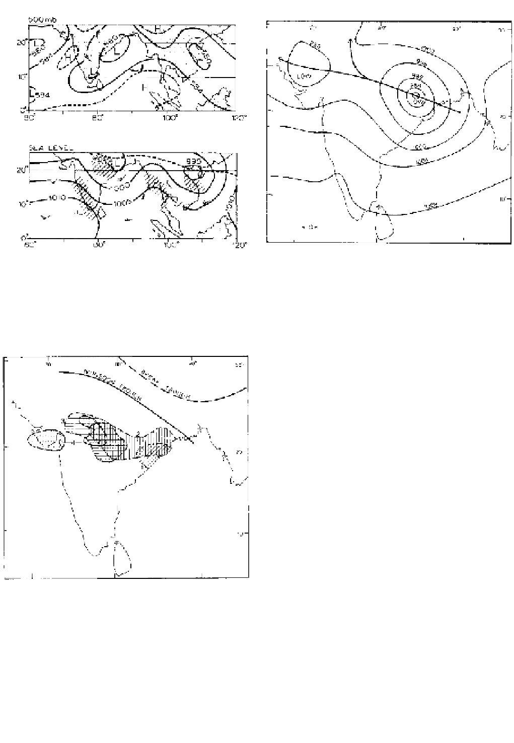
Figure 11.27
Monsoon depressions of 12:00 GMT, 4 July 1957.
(A) shows the height (in tens of metres) of the 500 mb surface;
(B), the sea-level isobars. The broken line in (B) represents
the equatorial trough, and precipitation areas are shown by the
oblique shading.
Source
: Based on the IGY charts of the Deutscher Wetterdienst.
Figure 11.28
The normal track of monsoon depressions,
together with a typical depression pressure distribution (mb).
Source
: After Das (1987). Copyright © 1987. Reproduced by per-
mission of John Wiley & Sons, Inc.
subcontinent (e.g. Bikaner and Kalat, Figure 11.20).
This is similar to the Sahel zone in West Africa, dis-
cussed below.
Around the head of the Bay of Bengal and along the
Ganges valley the main weather mechanisms in summer
are the 'monsoon depressions' (Figure 11.27), which
usually move westward or northwestward across India,
steered by the upper easterlies (Figure 11.28), mainly
in July and August. On average, they occur about twice
a month, apparently when an upper trough becomes
superimposed over a surface disturbance in the Bay
of Bengal. Monsoon depressions have cold cores, are
generally without fronts and are some 1000 to 1250 km
across, with a cyclonic circulation up to about 8 km,
and a typical lifetime of two to five days. They produce
average daily rainfalls of 1200 to 2000 mm, occurring
mainly as convective rains in the southwest quadrant of
the depression. The main rain areas typically lie south
of the equatorial or monsoon trough (Figure 11.29) (in
the southwest quadrant of the monsoon depressions,
resembling an inverted mid-latitude depression). Figure
11.30 shows the extent and magnitude of a particularly
severe monsoon depression. Such storms occur mainly
in two zones: (1) the Ganges valley east of 76 °E; (2) a
belt across central India at around 21°N, at its widest
covering 6° of latitude. Monsoon depressions also tend
Figure 11.29
The location of the monsoon trough in its normal
position during an active summer monsoon phase (solid) and
during breaks in the monsoon (dashed).* Areas 1 to 4 indicate
four successive daily areas of heavy rain ([more] 50 mm/day)
during the period 7 to 10 July 1973 as a monsoon depression
moved west along the Ganges valley. Areas of lighter rainfall were
much more extensive.
Source
: *After Das (1987). Copyright © 1987. Reproduced by
permission of John Wiley & Sons, Inc.