Geoscience Reference
In-Depth Information
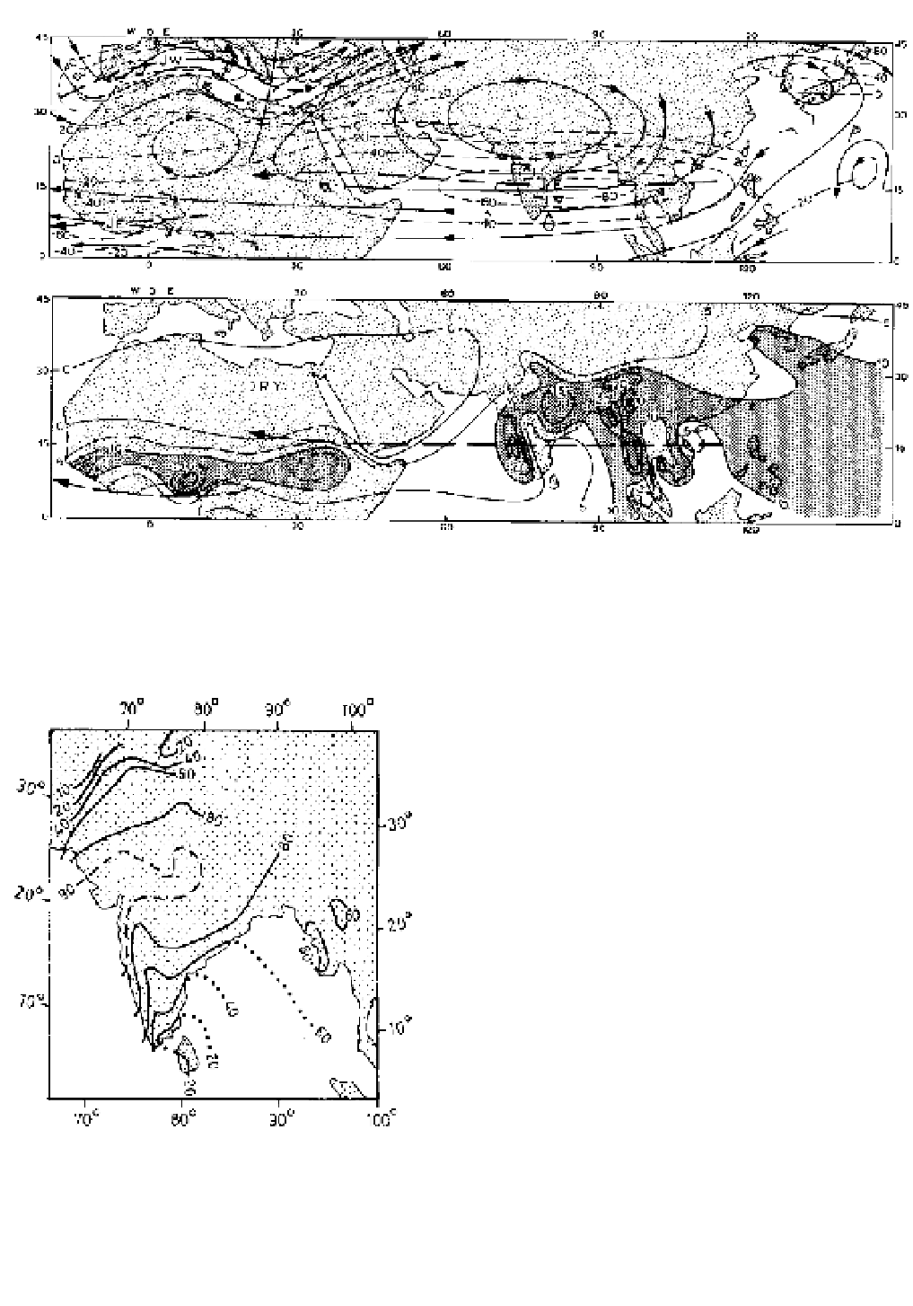
A
B
Figure 11.25
The easterly tropical jet stream. (A) The location of the easterly jet streams at 200 mb on 25 July 1955. Streamlines
are shown in solid lines and isotachs (wind speed) dashed. Wind speeds are given in knots (westerly components positive, easterly
negative). (B) The average July rainfall (shaded areas receive more than 25 cm) in relation to the location of the easterly jet streams.
Source
: From Koteswaram (1958).
plateau. The southwest monsoon in South Asia is
overlain by strong upper easterlies (see Figure 11.19)
with a pronounced jet at 150 mb (about 15 km), which
extends westward across South Arabia and Africa
(Figure 11.25). No easterly jets have been observed
so far over the tropical Atlantic or Pacific. The jet is
related to a steep lateral temperature gradient, with the
upper air getting progressively colder to the south.
An important characteristic of the tropical easterly jet
is the location of the main belt of summer rainfall on
the right (i.e. north) side of the axis upstream of the wind
maximum and on the left side downstream, except for
areas where the orographic effect is predominant (see
Figure 11.25). The mean jet maximum is located at
about 15 °N, 50 to 80 °E.
The monsoon current does not give rise to a simple
pattern of weather over India, despite the fact that
much of the country receives 80 per cent or more of its
annual precipitation during the monsoon season (Figure
11.26). In the northwest, a thin wedge of monsoon air
is overlain by subsiding continental air. The inversion
prevents convection and consequently little or no rain
falls in the summer months in the arid northwest of the
Figure 11.26
The percentage contribution of the monsoon
rainfall (June to September) to the annual total.
Sources
: After Rao and Ramamoorthy, in Indian Meteorological
Department (1960); and Ananthakrishnan and Rajagopalachari, in
Hutchings (1964).