Geoscience Reference
In-Depth Information
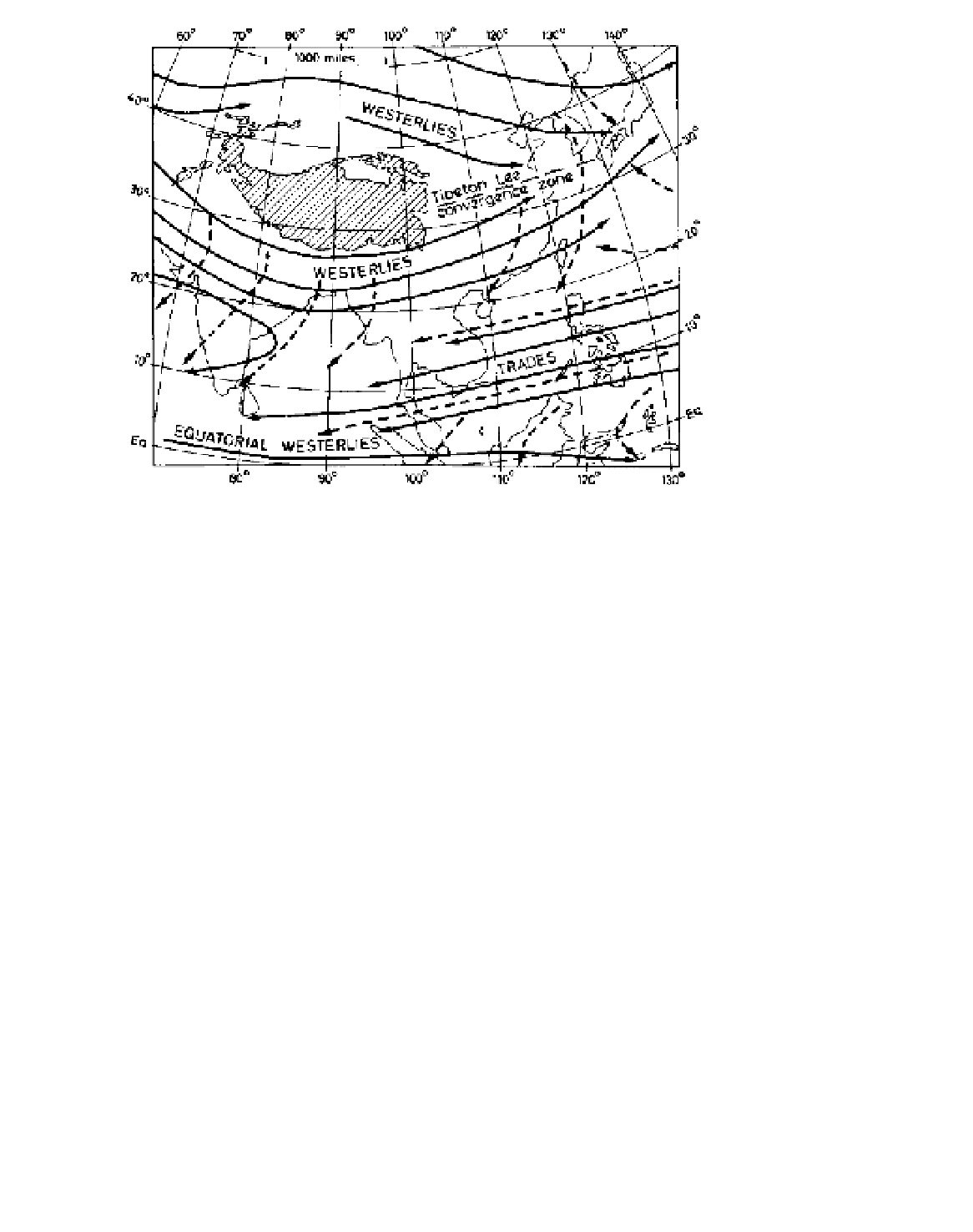
Figure 11.18
The characteristic air
circulation over South and East Asia in
winter. Solid lines indicate airflow at
about 3000 m, and dashed lines
at about 600 m. The names refer to
the wind systems aloft.
Sources
: After Thompson (1951), Flohn
(1968), Frost and Stephenson (1965),
and others.
probable that this factor, combined with the thermal
effect of the barrier to the north, is responsible for the
anchoring of the southern jet. This branch is the
stronger, with an average speed of more than 40 ms
-1
at
200 mb, compared with about 20 to 25 m s
-1
in the
northern jet. Where the two unite over north China
and south Japan the average speed exceeds 66 m s
-1
(Figure 11.19).
Air subsiding beneath this upper westerly current
gives dry out-blowing northerly winds from the sub-
tropical anticyclone over northwest India and Pakistan.
The surface wind direction is northwesterly over most
of northern India, becoming northeasterly over Burma
and Bangladesh and easterly over peninsular India.
Equally important is the steering of winter depressions
over northern India by the upper jet. The lows, which
are not usually frontal, appear to penetrate across the
Middle East from the Mediterranean and are important
sources of rainfall for northern India and Pakistan
(e.g. Kalat, Figure 11.20), especially as it falls when
evaporation is at a minimum. The equatorial trough of
convergence and precipitation lies between the equator
and about latitude 15°S (see Figure 11.16).
Some of these westerly depressions continue
eastward, redeveloping in the zone of jet stream
confluence about 30°N, 105°E over China, beyond the
area of subsidence in the immediate lee of Tibet (see
Figure 11.18). It is significant that the mean axis of the
winter jet stream over China shows a close correlation
with the distribution of winter rainfall (Figure 11.21).
Other depressions affecting central and north China
travel within the westerlies north of Tibet or are initiated
by outbreaks of fresh cP air. In the rear of these
depressions are invasions of very cold air (e.g. the buran
blizzards of Mongolia and Manchuria). The effect of
such cold waves, comparable with the northers in the
central and southern United States, is to greatly reduce
mean temperatures (Figure 11.22). Winter mean
temperatures in less-protected southern China are
considerably below those at equivalent latitudes in
India; for example, temperatures in Calcutta and Hong
Kong (both at approximately 22.5 (N) are 19°C and
16°C in January and 22 °C and 15°C in February,
respectively.
2 Spring
The key to change during this transition season is again
found in the pattern of the upper airflow. In March, the
upper westerlies begin their seasonal migration
northward, but whereas the northerly jet strengthens and
begins to extend across central China and into Japan,
the southerly branch remains positioned south of Tibet,
although weakening in intensity.
In April there is weak convection over India, where
the circulation is dominated by subsiding air originating