Geoscience Reference
In-Depth Information
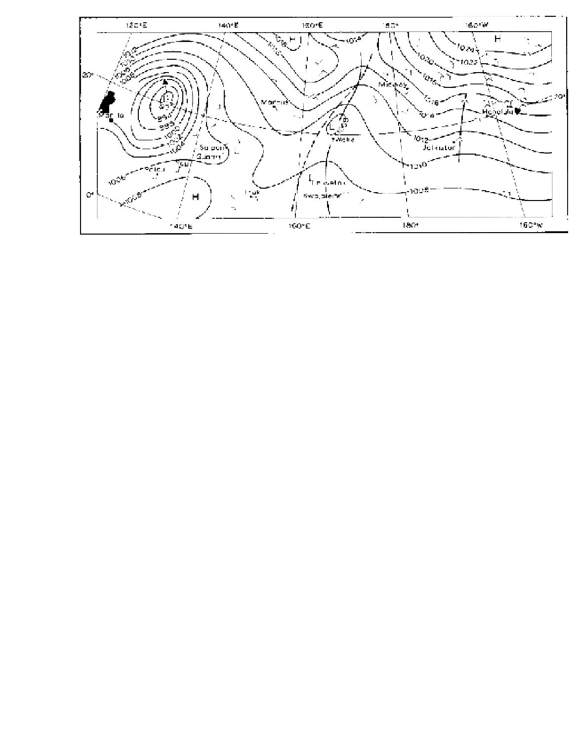
Figure 11.7
The surface synoptic chart for part of the northwest Pacific on 17 August 1957. The movements of the central wave
trough and of the closed circulation during the following twenty-four hours are shown by the dashed line and arrow, respectively. The
dashed L just east of Saipan indicates the location in which another low-pressure system subsequently developed. Plate 26 shows the
cloud formation along the convergence zone just east of Wake Island.
Source
: From Malkus and Riehl (1964).
hemisphere is paired with convergence behind a trough
line located further to the west in the southern hemi-
sphere. The reader may confirm that this should be so by
applying the equation for the conservation of potential
vorticity, remembering that both f and
The typical hurricane system has a diameter of about
650 km, less than half that of a mid-latitude depression
(Plate 23), although typhoons in the western Pacific are
often much larger. The central pressure is commonly
950 mb and exceptionally falls below 900 mb. Named
tropical storms are those defined as having one-minute
average wind velocities of at least 18 m s
-1
at the surface.
If these winds intensify to at least 33 m s
-1
, the named
storm becomes a tropical cyclone. Five hurricane inten-
sity classes are distinguished: category (1) weak (winds
of 33 to 42 m s
-1
); (2) moderate (43 to 49 m s
-1
); (3)
strong (50 to 58 m s
-1
); (4) very strong (59 to 69 m s
-1
)
and (5) devastating (70 m s
-1
or more). Hurricane
Camille, which struck coastal Mississippi in August
1969, was a category (5) storm, while Hurricane
Andrew, which devastated southern Florida in August
1992, has been reclassified also as a category (5) storm.
In 1997 there were eleven super-typhoons in the north-
west Pacific with winds >66 ms
-1
. The great vertical
development of cumulonimbus clouds, with tops at over
12,000 m, reflects the immense convective activity
concentrated in such systems. Radar and satellite studies
show that the convective cells are normally organized
in bands that spiral inward towards the centre.
Although the largest cyclones are characteristic of
the Pacific, the record is held by the Caribbean hurricane
operate in the
reverse sense in the southern hemisphere.
ζ
2 Cyclones
a Hurricanes and typhoons
The most notorious type of cyclone is the hurricane
(or typhoon). Some eighty or so cyclones each year are
responsible, on average, for 20,000 fatalities, as well as
causing immense damage to property and a serious
shipping hazard, due to the combined effects of high
winds, high seas, flooding from the heavy rainfall and
coastal storm surges. Considerable attention has been
given to forecasting their development and movement,
so their origin and structure are beginning to be under-
stood. Naturally, the catastrophic force of a hurricane
makes it a very difficult phenomenon to investigate, but
information is obtained from aircraft reconnaissance
flights sent out during the 'hurricane season', from radar
observations of cloud and precipitation structure (Plate
F), and from satellite data (see Plate 27).