Geoscience Reference
In-Depth Information
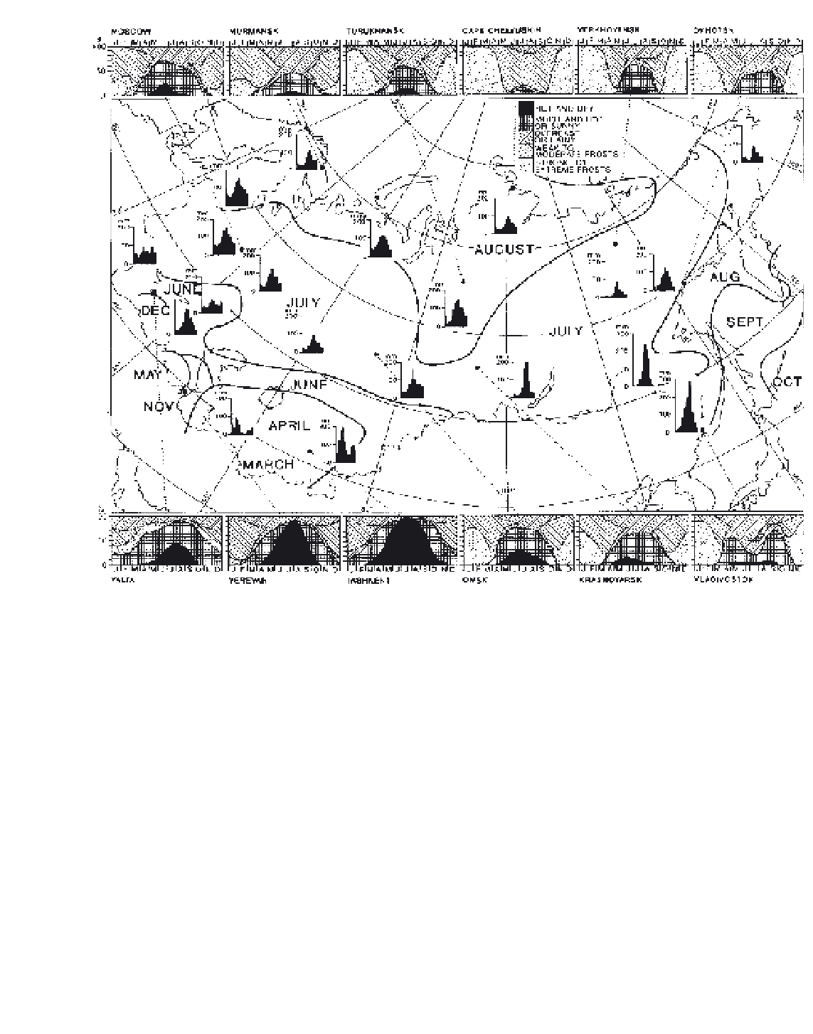
Figure 10.37
Months of maximum precipitation, annual regimes of mean monthly precipitation and annual regimes of mean monthly
frequencies of five main weather types in the former USSR showing the climate severity of the Arctic coast.
Source
: Reprinted from P. E. Lydolph (1977), with kind permission from Elsevier Science NL, Sara Burgerhartstraat 25, 1055 KV Amsterdam,
The Netherlands.
largely balances the annual thermodynamic ice growth
in the Arctic Basin. In late summer, the Eurasian shelf
seas and the coastal section of the Beaufort Sea are
mostly ice-free.
In summer, the Arctic Ocean has mostly overcast
conditions with low stratus and fog. Snowmelt and
extensive meltwater puddles on the ice keep air tem-
peratures at around freezing. Low-pressure systems tend
to predominate, entering the basin from either the North
Atlantic or Eurasia. Precipitation may fall as rain or
snow, with the largest monthly totals in late summer to
early autumn. However, the mean annual net pre-
cipitation minus evaporation over the Arctic, based on
atmospheric moisture transport calculations, is only
about 180 mm.
On Arctic land areas there is a stable snow cover
from mid-September until early June, when melt occurs
within ten to fifteen days. As a result of the large
decrease in surface albedo, the surface energy budget
undergoes a dramatic change to large positive values
(Figure 10.38). The tundra is generally wet and boggy
as a result of the
permafrost table
only 0.5 to 1.0 m
below the surface, which prevents drainage. Thus the
net radiation is expended primarily for evapotran-
spiration. Permanently frozen ground is over 500-m
thick in parts of Arctic North America and Siberia and
extends under the adjacent Arctic coastal shelf areas.
Much of the Queen Elizabeth Islands, the Northwest
Territories of Canada and the Siberian Arctic Islands is
cold, dry polar desert, with gravel or rock surfaces, or