Geoscience Reference
In-Depth Information
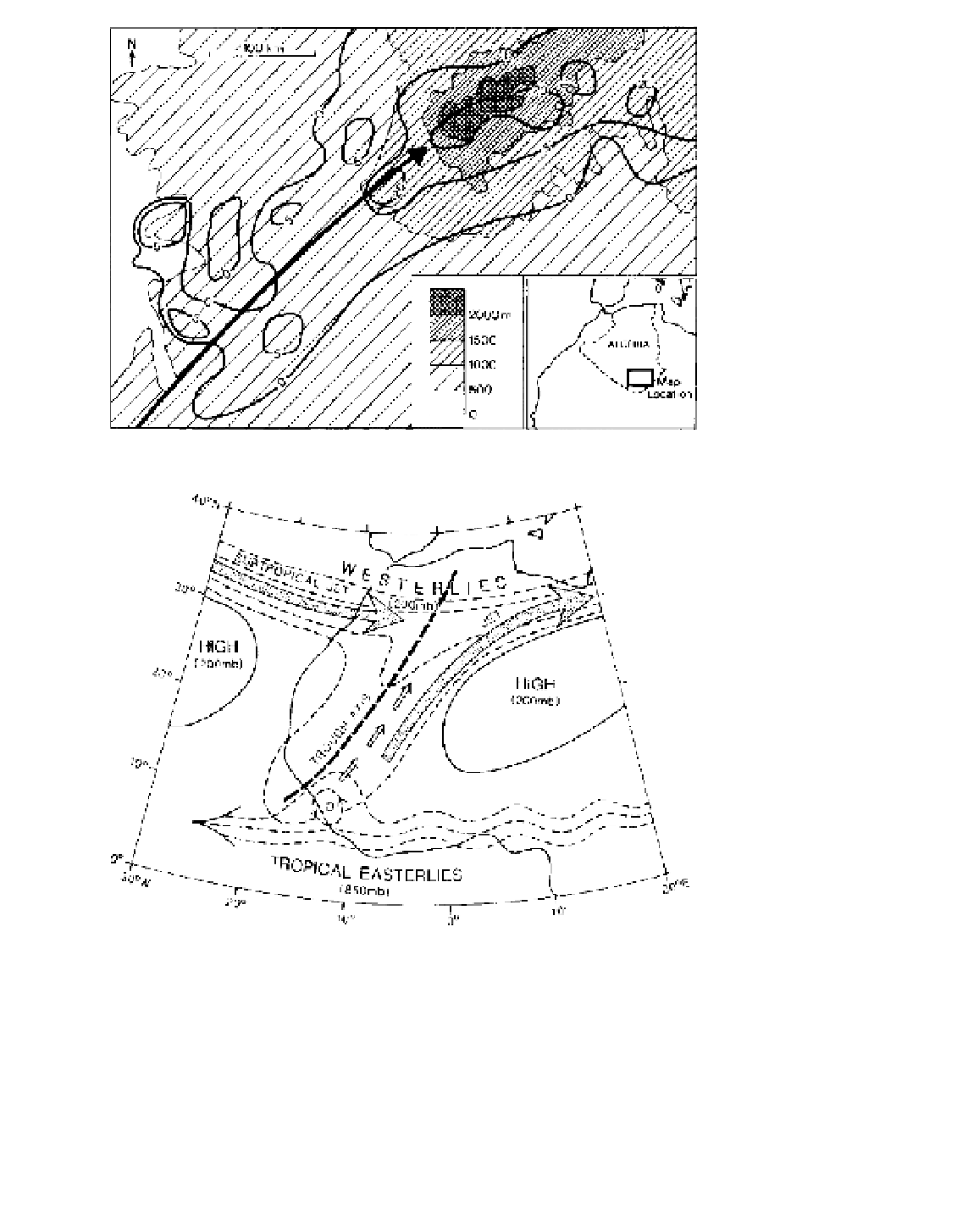
Figure 10.30
Track of a storm and
the associated three-hour rainfall
(mm) during September 1950 around
Tamanrasset in the vicinity of the
Ahaggar Mountains, southern Algeria.
Source
:
Partly
after
Goudie
and
Wilkinson (1977).
Figure 10.31
Interaction between
the westerlies and the tropical east-
erlies leading to the production of
Saharan depressions (D), which move
northeastward along a trough axis.
Source
: After Nicholson and Flohn
(1980), copyright © 1980/1982 D.
Reidel Publishing Company. Reprinted
by permission.
a stable anticyclone over Australia (Figure 10.32).
About forty anticyclones traverse Australia annually,
being somewhat more numerous in spring and summer
than in autumn and winter. Over both oceans, the
frequency of anticyclonic centres is greatest in a belt
around 30°S in winter and 35-40°S in summer; they
rarely occur south of 45°S.
Between successive anticyclones are low-pressure
troughs containing inter-anticyclonic fronts (sometimes
termed 'polar') (Figure 10.33). Within these troughs,
the subtropical jet stream meanders equatorward,
accelerates (particularly in winter, when it reaches an
average velocity of 60 ms
-1
compared with a mean
annual value of 39 ms
-1
) and generates upper-air
depressions, which move southeastward along the front
(analogous to the systems in North Africa). The
variation in strength of the continental anticyclones and
the passage of inter-anticyclonic fronts cause periodic
inflows of surrounding maritime tropical airmasses
from the Pacific (mTp) and the Indian (mTi) oceans. In