Geoscience Reference
In-Depth Information
This jet develops during low index phases, when the
westerlies over the eastern Atlantic are distorted by
a blocking anticyclone at about 20°W. This leads to a
deep stream of Arctic air flowing southward over the
British Isles and France.
Low-pressure systems in the Mediterranean have
three main sources. Atlantic depressions entering the
western Mediterranean as surface lows make up 9 per
cent and 17 per cent form as baroclinic waves south of
the Atlas Mountains (the so-called Saharan depressions;
see Figure 10.27). The latter are important sources of
rainfall in late winter and spring). Fully 74 per cent
develop in the western Mediterranean in the lee of the
Alps and Pyrenees (see Chapter 9H.1). The combination
of the lee effect and that of unstable surface air over
the western Mediterranean explains the frequent
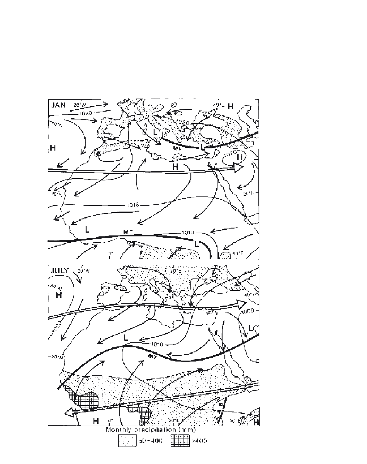
Figure 10.26
The distribution of surface
pressure, winds and precipitation for
the Mediterranean and North Africa
during January and July. The average
positions of the subtropical westerly
and tropical easterly jet streams, together
with the monsoon trough (MT), the
Mediterranean front (MF) and the Zaire
air boundary (ZAB), are also shown.
Source
: Partly after
Weather in the
Mediterranean
(HMSO, 1962) (Crown
Copyright Reserved).