Geoscience Reference
In-Depth Information
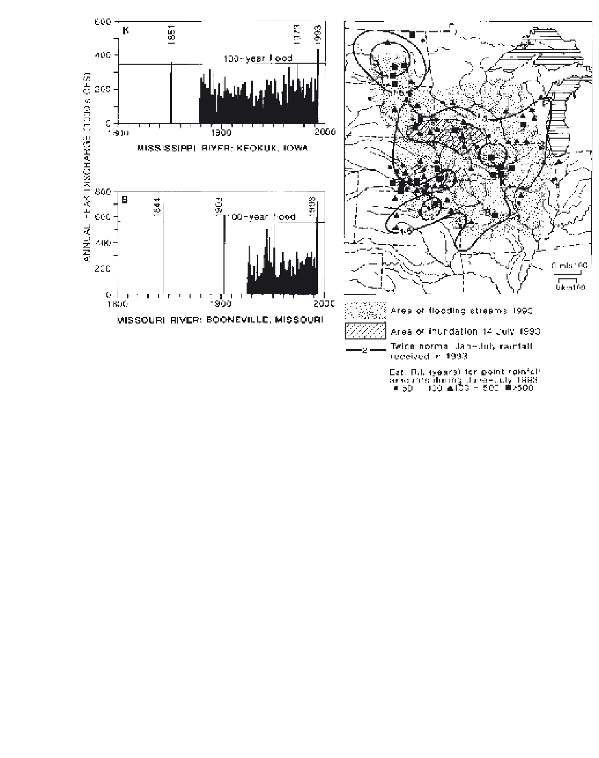
Figure 10.21
Distribution of flooding streams and inundation in the US Midwest during the period June to August 1993. Peak
discharges for the Mississippi River at Keokuk, Iowa (K) and the Missouri River at Booneville, Missouri (B) are shown, together with
the historic annual peak discharge record. The isopleths indicate the multiples of the thirty-year average January to July precipitation
that fell in the first seven months of 1993, and the symbols the estimated recurrence intervals (R.I. years) for point rainfall amounts
received during June to July 1993.
Sources
: Parrett
et al
. (1993) and Lott (1994). Courtesy of the US Geological Survey.
precipitation falls during nocturnal thunderstorms
(20:00 to 08:00 True Solar Time) in central Kansas,
parts of Nebraska, Oklahoma and Texas. Hypotheses
suggest that the nocturnal thunderstorm rainfall that
occurs, especially with extensive mesoscale convec-
tive systems (see p. 203), may be linked to a tendency
for nocturnal convergence and rising air over the
plains east of the Rocky Mountains. The terrain
profile appears to play a role here, as a large-scale
inversion layer forms at night over the mountains,
setting up a low-level jet east of the mountains just
above the boundary layer. This southerly flow, at
500 to 1000 m above the surface, can supply the
necessary low-level moisture influx and convergence
for the storms (cf. Figure 9.33). MCSs account for 30
to 70 per cent of the May to September rainfall over
much of the area east of the Rocky Mountains to the
Missouri River.
3
East of the upper Mississippi, in the Ohio valley and
south of the lower Great Lakes, there is a transitional
regime between that of the interior and the east
coast type. Precipitation is reasonably abundant
in all seasons, but the summer maximum is still in
evidence (e.g. Dayton).
4
In eastern North America (New England, the
Maritimes, Quebec and southeast Ontario), pre-
cipitation is distributed fairly evenly throughout the
year (e.g. Blue Hill). In Nova Scotia and locally
around Georgian Bay there is a winter maximum,
due in the latter case to the influence of open water.