Geoscience Reference
In-Depth Information
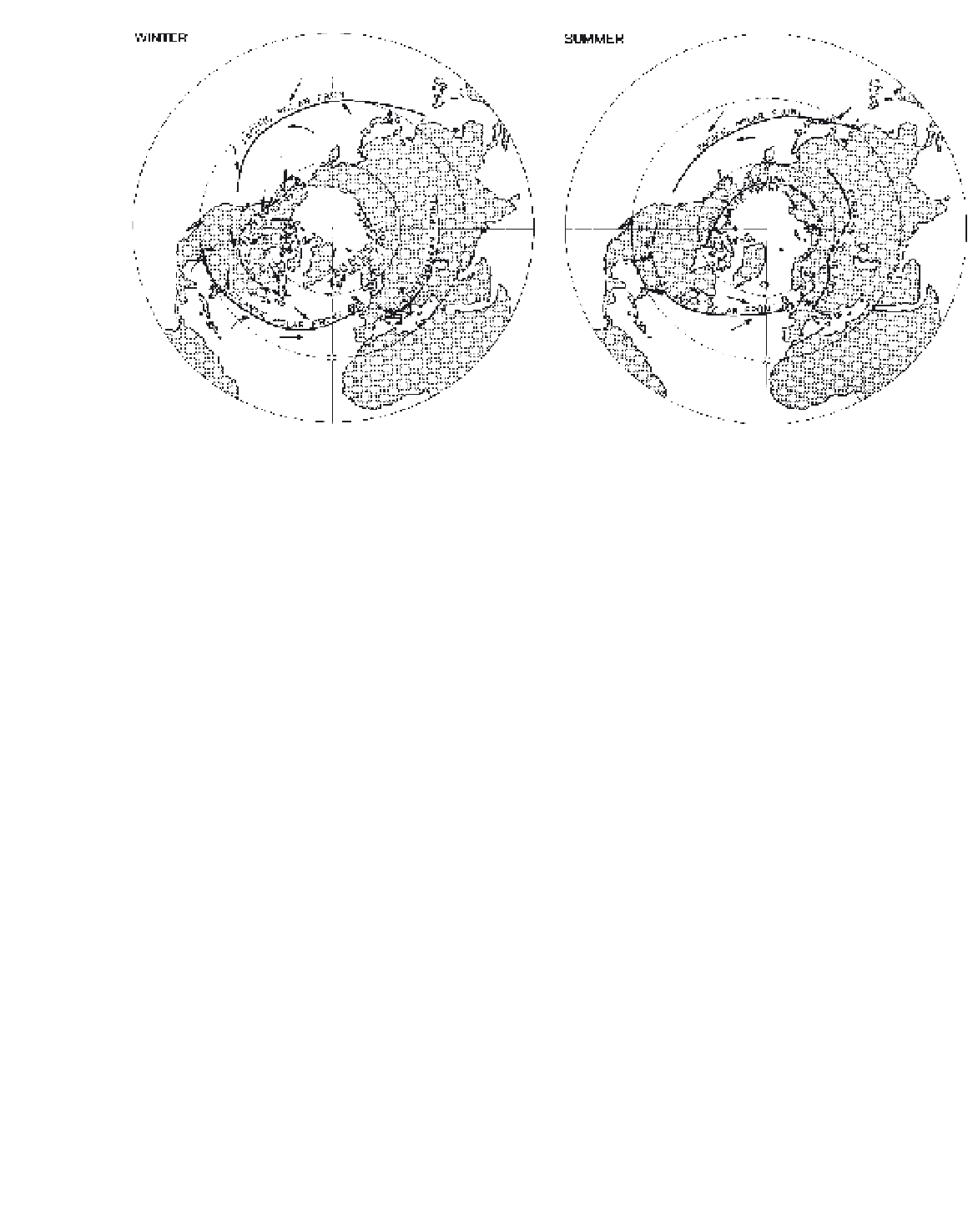
Figure 9.19
The major northern hemisphere frontal zones in winter and summer.
initiates frontogenesis. In summer, the Azores sub-
tropical anticyclone influences the area, and the frontal
zone is absent.
The summer locations of the polar front over
the western Atlantic and Pacific are some 10° further
north than in winter (see Figure 9.19), although the
summer frontal zone is rather weak. There is a frontal
zone over Eurasia and a corresponding one over middle
North America. These reflect the general meridional
temperature gradient and also the large-scale influence
of orography on the general circulation (see G, this
chapter).
In the southern hemisphere, the polar front is on
average about 45°S in January (summer), with branches
spiralling poleward towards it from about 32°S off
eastern South America and from 30°S, 150°W in the
South Pacific (Figure 9.20). In July (winter), there are
two polar frontal zones spiralling towards Antarctica
from about 20°S; one starts over South America and the
other at 170°W. They terminate some 4 to 5° latitude
further poleward than in summer. It is noteworthy that
the southern hemisphere has more cyclonic activity
in summer than does the northern hemisphere in its
summer. This appears to be related to the seasonal
strengthening of the meridional temperature gradient
(see p. 133).
The second major frontal zone is the Arctic front,
associated with the snow and ice margins of high
latitudes (see Figure 9.19). In summer, this zone is
developed at the land-sea boundary in Siberia and North
America. In winter over North America, it is formed
between cA (or cP) air and Pacific maritime air modified
by crossing the coast ranges and the Rocky Mountains
(see Plate 18). There is also a less pronounced Arctic
frontal zone in the North Atlantic-Norwegian Sea area,
extending along the Siberian coast. A similar weak
frontal zone is found in winter in the southern hemi-
sphere. It is located at 65 to 70°S near the edge of the
Antarctic pack-ice in the Pacific sector (see Figure 9.20),
although few cyclones form there. Zones of airstream
confluence in the southern hemisphere (cf. Figures 9.2B
and 9.4B) are fewer and more persistent, particularly in
coastal regions, than in the northern hemisphere.
The principal tracks of depressions in the northern
hemisphere in January are shown in Figure 9.21. The
major tracks reflect the primary frontal zones discussed
above. In summer, the Mediterranean route is absent
and lows move across Siberia; the other tracks are
similar, although more zonal and located in higher
latitudes (around 60°N).
Between the two hemispherical belts of subtropical
high pressure there is a further major convergence zone,
the intertropical convergence zone (ITCZ). This was
formerly designated as the intertropical front (ITF),
but airmass contrasts are not typical. The ITCZ moves
seasonally away from the equator, as the subtropical
high-pressure cell activity alternates in opposite hemi-
spheres. The contrast between the converging airmasses