Geoscience Reference
In-Depth Information
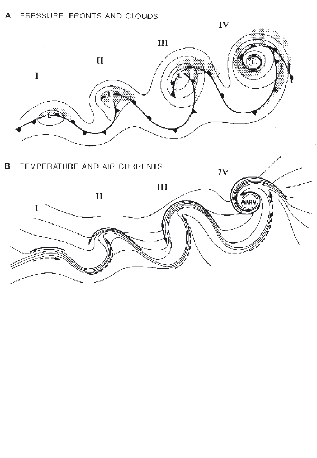
Figure 9.9
Stages in the life cycle of a marine extratropical depression showing: (I) Incipient frontal depression; (II) Frontal fracture;
(III) Bent-back warm front and frontal T-bone; (IV) Warm-core seclusion. (A) Schematic isobars of sea-level pressure, fronts and cloud
cover (stippled). (B) Isotherms and flows of cold air (solid arrows) and warm air (dashed arrows).
Source
: After Shapiro and Keyser (1990), by permission of the American Meteorological Society.
1 The warm front
altostratus (Figure 9.11A). The sun is obscured as the
altostratus layer thickens and drizzle or rain begins to
fall. The cloud often extends through most of the
troposphere and, with continuous precipitation
occurring, is generally designated as nimbostratus.
Patches of fracto-stratus may also form in the cold air as
rain falling through this air undergoes evaporation and
quickly saturates it.
The descending warm air of the kata-warm front
greatly restricts the development of medium- and high-
level clouds. The frontal cloud is mainly stratocumulus,
The warm front represents the leading edge of the warm
sector in the wave. The frontal boundary has a very
gentle slope of the order of 0.5-1°, so the cloud systems
associated with the upper portion of the front herald its
approach some twelve hours or more before the arrival
of the surface front (see Plate 17). The ana-warm front,
with rising warm air, has multi-layered cloud that
steadily thickens and lowers towards the surface
position of the front. The first clouds are thin, wispy
cirrus, followed by sheets of cirrus and cirrostratus, and