Geoscience Reference
In-Depth Information
anticyclones. Clearly, these features await a definitive
and comprehensive explanation.
It is probable that the high-level anticyclonic
cells that are evident on synoptic charts (these tend
to merge on mean maps) are related to anticyclonic
eddies that develop on the equatorward side of jet
streams. Theoretical and observational studies show
that, as a result of the latitudinal variation of the Coriolis
parameter, cyclones in the westerlies tend to move
poleward and anticyclonic cells equatorward. Hence the
subtropical anticyclones are constantly regenerated.
There is a statistical relationship between the latitude of
the subtropical highs and the mean meridional temper-
ature gradient (see Figure 7.11); a stronger gradient
causes an equatorward shift of the high pressure, and
vice versa. This shift is evident on a seasonal basis.
The cellular pattern at the surface clearly reflects the
influence of heat sources. The cells are stationary and
elongated north-south over the northern hemisphere
oceans in summer, when continental heating creates low
pressure and also the meridional temperature gradient
is weak. In winter, on the other hand, the zonal flow is
stronger in response to a greater meridional temperature
gradient, and continental cooling produces east-west
elongation of the cells. Undoubtedly, surface and high-
level factors reinforce one another in some sectors and
tend to cancel each other out in others.
Just as Hadley circulations represent major merid-
ional (i.e. north-south) components of the atmospheric
circulation, so Walker circulations represent the large-
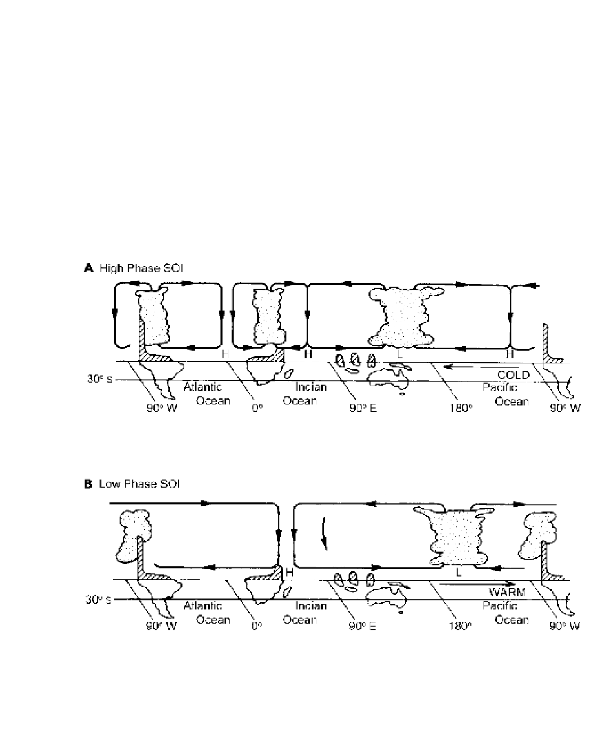
Figure 7.22
Schematic cross-sections of the Walker circulation along the equator (based on computations of Y. Tourre (1984))
during the high (A) and low (B) phases of the Southern Oscillation (SO). The high (low) phases correspond to non-ENSO (ENSO)
patterns (see p. 146). In the high phase there is rising air and heavy rains over the Amazon basin, central Africa and Indonesia, western
Pacific. In the low phase (ENSO 1982-83) pattern the ascending Pacific branch is shifted east of the date-line and elsewhere convection
is suppressed due to subsidence. The shading indicates the topography in exaggerated vertical scale.
Source
: Based on K. Wyrtki (by permission of the World Meteorological Organization 1985).