Geoscience Reference
In-Depth Information
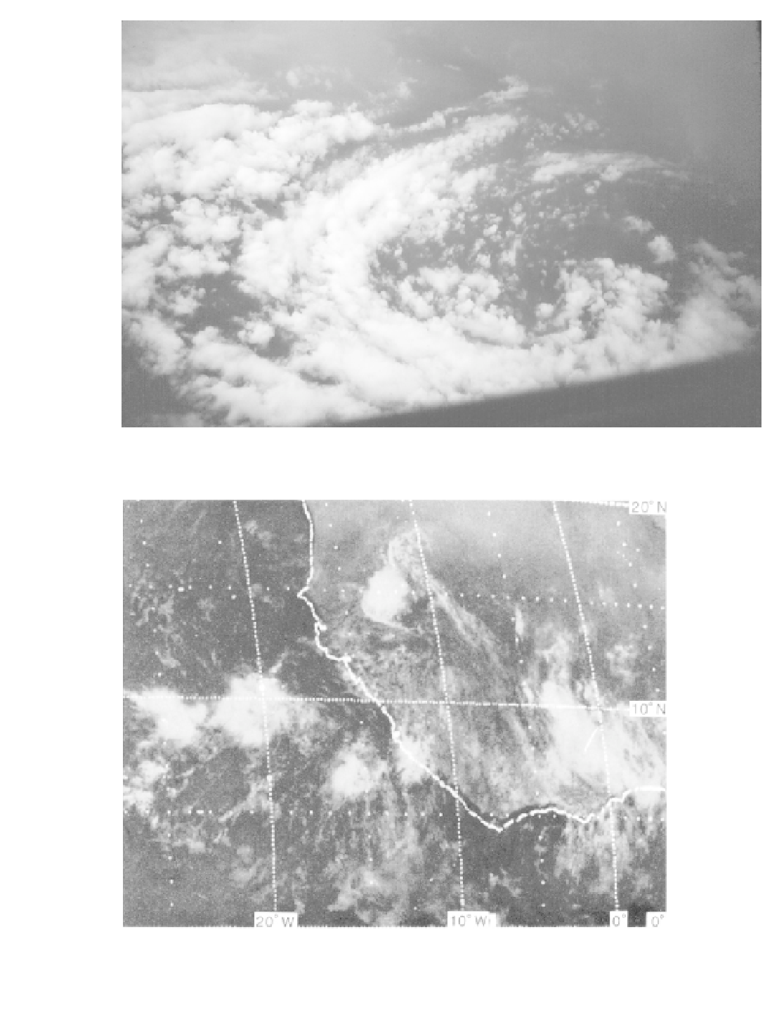
Plate 28
In the eye of Hurricane Caroline, 30 August 1975 (
courtesy of NOAA, Flying with NOAA Collection fly 00174
).
Plate 29
Visible satellite image showing five large tropical cloud clusters topped by cirrus shields
situated between latitudes 5° and 10°N in the vicinity of West Africa, together with one squall line cloud
cluster at 15°N having a well-defined arc cloud squall line on its leading (southwest) edge. Taken by SMS-
1 satellite at 11:30 hours GMT on 5 September 1974 (
courtesy of NOAA
).