Geoscience Reference
In-Depth Information
13.3 Volcanic eruptions and climate
The eruption of Krakatoa in Indonesia in 1883 demonstrated the global significance of large
explosive events in andesitic volcanic cones. The eruption, which injected dust and sulfur gases
into the stratosphere, was followed by cool conditions and dramatic red sunsets around the world.
However, after the 1912 eruption of Katmai in the Aleutian Islands there was a lull in volcanic activity
until Agung in Bali erupted in 1963. Plumes from equatorial eruptions can disperse into both
hemispheres whereas those in middle and high latitudes cannot be transferred equatorward due
to the upper circulation structure. Non-explosive eruptions of basaltic shield volcanoes of the
Hawaiian type do not inject material into the stratosphere.
Volcanic aerosols are often measured in terms of a dust veil index (DVI), first proposed by H. H.
Lamb, that takes account of the maximum depletion of monthly average direct incoming radiation
measured in the mid-latitudes of the hemisphere concerned, the maximum spatial extent of the
dust veil, and persistence of the dust veil. However, this cannot be directly calculated for historical
events.
The largest DVI values are estimated for 1835 and 1815-1816. Volcanologists use a Volcanic
Explosivity Index (VEI) to rank eruptions on a scale of 0-8. El Chichon (1982) and Agung (1963) are
rated 4, but the index may not necessarily be a good indicator of climatic effects.
The surface cooling agents include both the
transformation of sulfur dioxide (a gas) into
sulfuric acid droplets (a reflective aerosol) and
microparticles of dust that absorb solar radiation
in the stratosphere (large particles rapidly settle
out). Increased acidity in the snow falling on ice
sheets can be measured by determining the signal
of electrical conductivity in an ice core. This yields
records of past eruptions.
Global average temperatures the year following
a major eruption may be reduced by several tenths
of a degree C, but impacts can be much larger
at hemispheric and regional scales. Dramatic
evidence of such effects was provided by the
'year without a summer' in 1816, following the
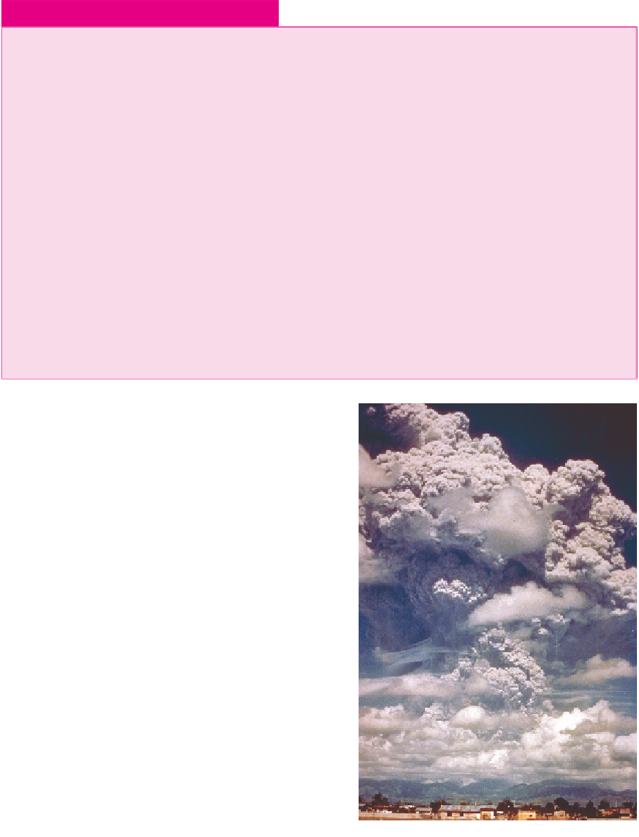
Plate 13.3
The first major eruption of Mt.
Pinatubo on 12 June 1991. Mt. Pinatubo is located
on the southwestern part of the island of Luzon in
the Philippines. Prior to 1991, it had been dormant
for more than 635 years.
Source: Photo credit, K. Jackson, U.S. Air Force.
NOAA/NGDC.