Geoscience Reference
In-Depth Information
70°
80°
90°E
30°N
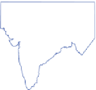
Figure 11.29
The location of the Monsoon
Trough in its normal position during an active
summer monsoon phase (solid) and during
breaks in the monsoon (dashed).* Areas 1-4
indicate four successive daily areas of heavy rain
(>50mm/day) during the period 7-10 July 1973
as a monsoon depression moved west along the
Ganges valley. Areas of lighter rainfall were
much more extensive.
Source:*After Das (1987). Copyright © 1987. Reproduced
by permission of John Wiley & Sons, Inc.
3
2
4
20°
1
10°
24°N
India
600
Jabalpur
23°
N
22°
100
0
miles
50
Land over 600m
Nagpur
0
km
50
21°
78°
79°
80°
81°
82°E
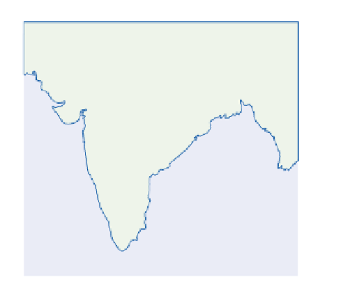
Figure 11.30
Rainfall (mm) produced in three days over a 50,000km
2
area of central India northeast of Nagpur by
a severe, westward-moving monsoon depression, during September 1926.
Source: Dhar and Nandargi (1993). Copyright © John Wiley & Sons Ltd. Reproduced with permission.