Geoscience Reference
In-Depth Information
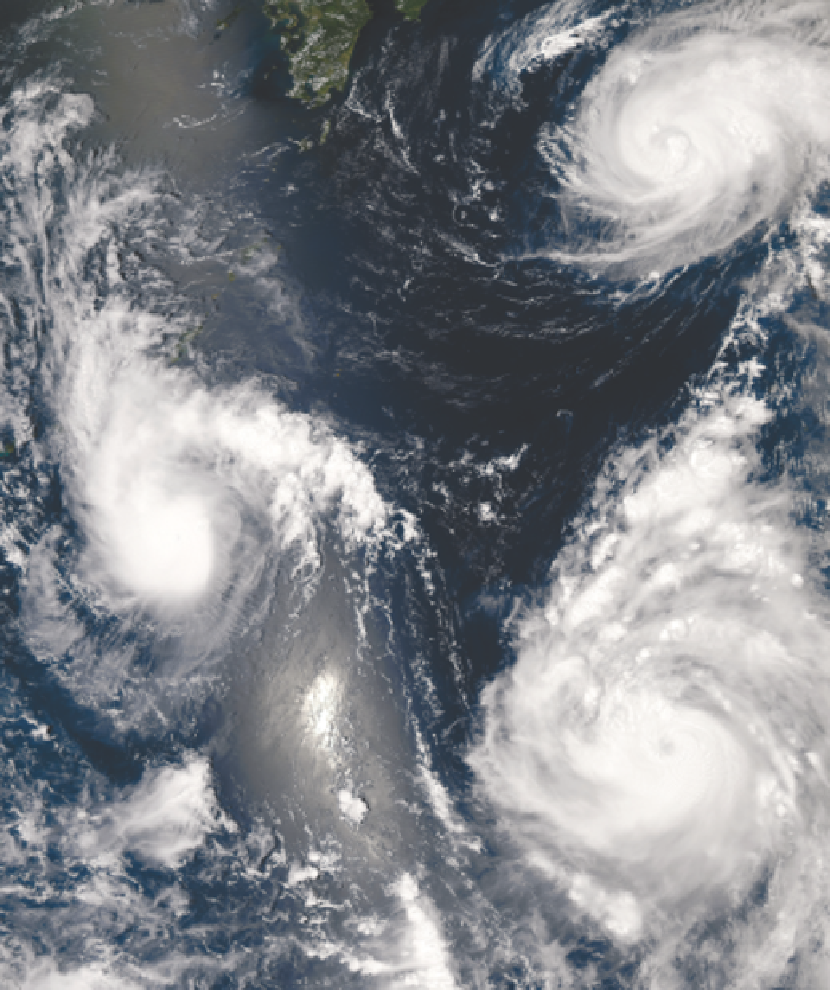
Plate 11.3
Three different typhoons were present over the western Pacific Ocean on 7 August, 2006, in this
Moderate Resolution Imaging Spectroradiometer (MODIS) view from NASA's Aqua satellite. The strongest of the
three, Typhoon Saomai (lower right), formed in the western Pacific on 4 August, 2006, as a tropical depression.
Within a day, it had become organized enough to be classified as a tropical storm. While Saomai was strengthening
into a storm, another tropical depression formed a few hundred kiolmeters to the north, and by 6 August, it became
tropical storm Maria (upper right). Typhoon Bopha (left) formed just as Maria reached storm status and became a
storm itself on 7 August. Bopha, the youngest at just a few hours old, shows only the most basic round shape of
a tropical storm. Maria, a day older, shows more distinct spiral structure with arms and an apparent central eye.
Despite their differences in appearance, both storms were around the same size and strength, with peak sustained
winds of around 90 and 100ku/hr, respectively. A day older than Maria is the much more powerful Typhoon Saomai.
At the time of this image, the typhoon had sustained winds of around 140km/hr.
Source:Jeff Schmaltz NASA Visible Earth.