Geoscience Reference
In-Depth Information
convergence of these air streams is often pro-
nounced and in this sector the term
Intertropical
Convergence Zone
(ITCZ) is applicable. Generally,
however, the convergence is discontinuous in
space and time. Equatorward of the main belts of
the trades over the eastern Pacific and eastern
Atlantic are regions of light, variable winds, known
traditionally as the
doldrums
and much feared in
past centuries by the crews of sailing ships. Their
seasonal extent varies considerably: from July to
September they spread westward into the central
Pacific while in the Atlantic they extend to the coast
of Brazil. A third major doldrum zone is located
in the Indian Ocean and western Pacific. In March
to April it stretches 16,000km from East Africa to
180
1
The Trade Winds
It might be thought that the term 'Trade Winds'
originated from the their importance in the days
of sail to fostering trade between the continents.
However, according to Wikipedia, the term 'Trade
Winds' is derived from the Middle English 'trade',
meaning 'path' or 'track', leading to the phrase,
'the winds blows trade'. With respect to the
climate system, the trades (or tropical easterlies)
are important because of their great extent,
affecting almost half the globe (see
Figure 7.13
).
They originate at low latitudes on the margins of
the subtropical high pressure cells, and their
constancy of direction and speed (about 7m s
-1
)
is remarkable. Trade Winds, like the westerlies,
are strongest during the winter half-year, which
suggests that they are both controlled by the same
fundamental mechanism.
The two Trade Wind systems tend to converge
in the
Equatorial Trough
(of low pressure). Over
the oceans, particularly the central Pacific, the
longitude and is again very extensive during
October to December.
°
2 The equatorial westerlies
In the summer hemisphere, and over continental
areas especially, there is a narrow zone of generally
120°E
150°E
180°
150°W
120°W
90°W
60°W
30°W
0°
30°E
60°E
90°E
120°E
150°E
75°N
75°N
60°N
60°N
30°N
30°N
M
O
0°
0°
D
30°S
30°S
60°S
120°E
150°E
180°
150°W
120°W
90°W
60°W
30°W
0°
30°E
60°E
90°E
120°E
150°E
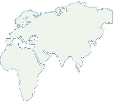
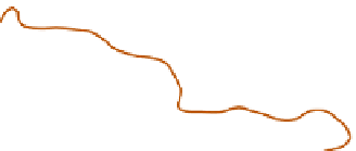
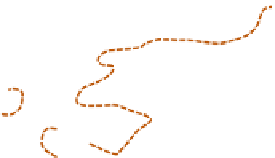
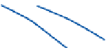
Figure 7.13
Map of the Trade Wind belts and the doldrums. The limits of the Trades - enclosing the area within
which 50 percent of all winds are from the predominant quadrant - are shown by the solid (January) and the dashed
(July) lines. The stippled area is affected by Trade Wind currents in both months. Schematic streamlines are indicated
by the arrows - dashed (July) and solid (January, or both months).
Source: Based on Crowe (1949, 1950).