Geoscience Reference
In-Depth Information
800
(A)
Wind velocity
12
700
048
16
20ms
-1
Wind velocity
500
600
0
48
12
16 ms
-1
500
500
200
400
200
50
300
10
4
50
200
0.5
10
100
4
0.5
2 L
0
800
600
400
0
Distance from hill crest (m)
200
200
400
600
800
Upwind
Downwind
100
(B)
80
60
40
20
0
-20
-40
-60
800
600
400
0
Distance from hill crest (m)
200
200
400
600
800
Upwind
Downwind
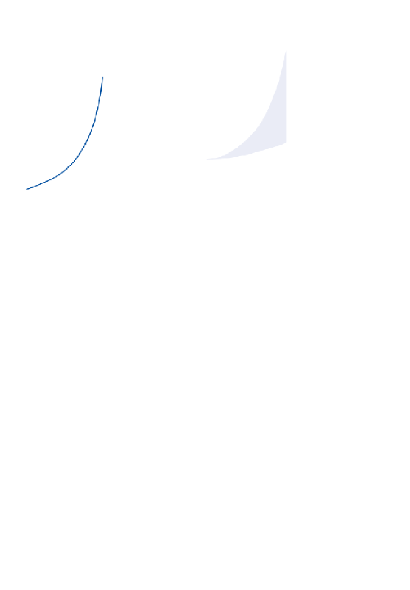
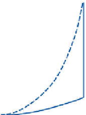
Figure 6.14
Airflow over Askervein Hill, South Uist, off the west coast of Scotland. A: Vertical airflow
profiles (not true to scale) measured simultaneously 800m upwind of the crest line and at the crest line. L
is the characteristic lengthof the obstruction (i.e. one-half the hill width at mid-elevation, here 500m) and
is also the height above ground level to which the flow is increased by the topographic obstruction
(shaded). The maximum speed-up of the airflow due to vertical convergence over the crest is to about
16.5m s
-1
at a height of 4m. B: the relative speed-up (%) of airflow upwind and downwind of the crest line
measured 14m above ground level.
Source: After Taylor, Teunissen and Salmon et al. From Troen and Petersen (1989).
Mountains. At Pincher Creek, Alberta, a temper-
ature rise of 21°C occurred in four minutes with
the onset of a chinook on 6 January 1966. In
California, the Santa Ana is a cold season easterly
wind that blows from the deserts east of the Sierra
Nevada to the coast of southern California. It has
an average frequency of 20 events per year and
average duration of 1.5 days. It is notable for
the dry air, which greatly increases the risk of
chaparral fires. Less spectacular effects are also