Geoscience Reference
In-Depth Information
3000
(A)
Oceans
2500
JJA
2000
Year
DJF
1500
1000
500
0
3000
(B)
Lands
DJF
2500
JJA
2000
1500
1000
Year
500
0
3000
(C)
Globe
2500
JJA
2000
1500
DJF
Year
1000
500
0
90°N
60°N
30°N
0°
30°S
60°S
90°S
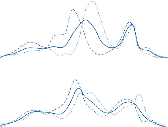
Figure 4.17
Mean precipitation (cm/yr) over A: the oceans, B: the land and C: globally for
December-February, June -August and annually.
Source: Peixoto and Oort (1983), Fig. 23. Copyright © D. Reidel, Dordrecht, by kind permission of Kluwer Academic Publishers.
northern and southern ranges. In western Britain,
with mountains of about 1000m, the maximum
falls are recorded to leeward of the summits.
This probably reflects the general tendency of air
to go on rising for a while after it has crossed the
crestline and the time lag involved in the
precipitation process after condensation. Over
narrow uplands, the horizontal distance may
allow insufficient time for maximum cloud
buildup and the occurrence of precipitation.
However, a further factor may be the effect of
eddies, set up in the airflow by the mountains, on
the catch of rain gauges. Studies in Bavaria at
the Hohenpeissenberg Observatory show that
standard rain gauges may overestimate amounts
by about 10 percent on the lee slopes and
underestimate them by 14 percent on windward
slopes.


