Geoscience Reference
In-Depth Information
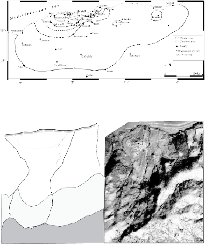
Fig. 6
Isoseismal map of the Villebourg earthquake of 15 January 1891 (Ms 6.0, I
0
IX EMS) (Vlb:
Villebourg, Gya: Gouraya)
Larh
a
t
Larhat
>100
m
>200
m
1
2
3
500 m
Fig. 7
The landslide reactivated by the Villebourg earthquake of 15 January 1891 (1: compressive
pad, 2: zone uplifted during the earthquake, 3: hydrographic network)
7 Discussion and Conclusion
The 2003 Zemmouri earthquake induced a large number of fatalities and serious
damage along the Algerian coast. The results of the detailed macroseismic survey
indicate the spatial distribution of the related effects in terms of an isoseismals
map and related intensity attenuation. A maximum intensity of X (EMS) has been
assessed inside numerous isolated areas separated by others with a lower intensity


Search WWH ::

Custom Search